Metro-Style Altitude Maps
Route diagrams drawn like metro maps, with interactive 2D and 3D maps, for high-altitude travel-medicine consults. Every place carries the altitude travellers reach, every line is coloured by the altitude of the ground under it, and every route shows which nights climb too fast. One region at a time, in English and the local language.
- Result
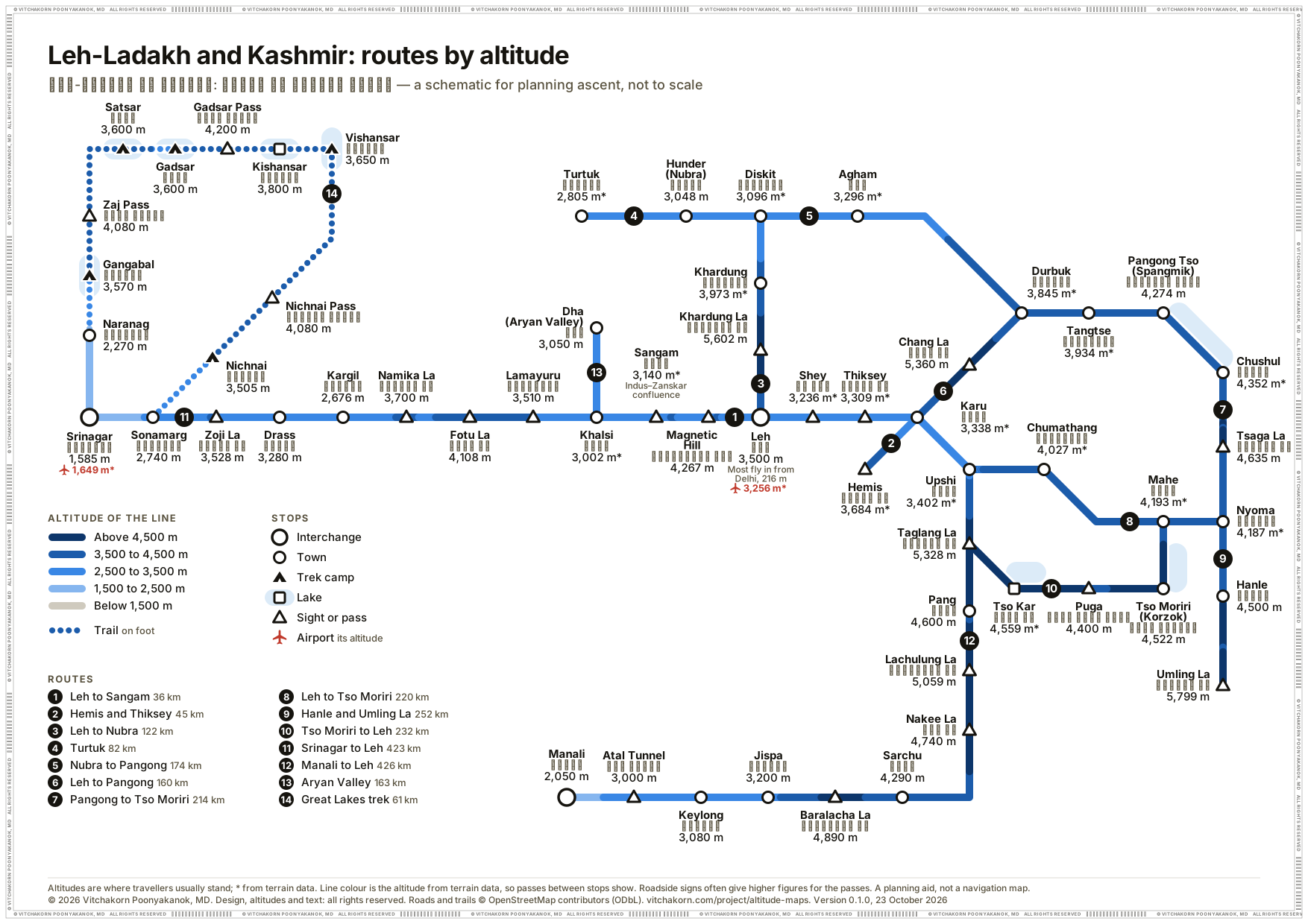
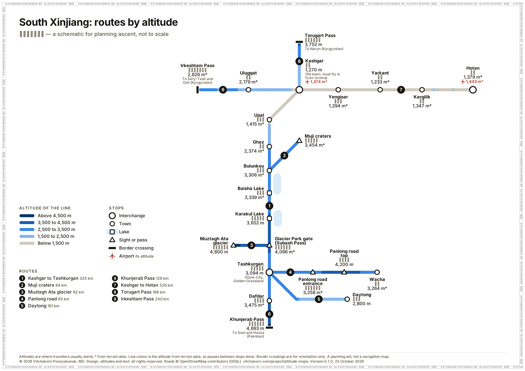
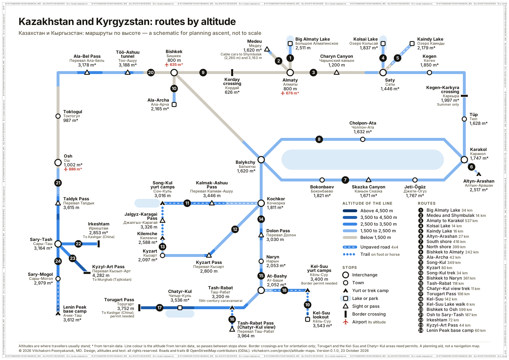
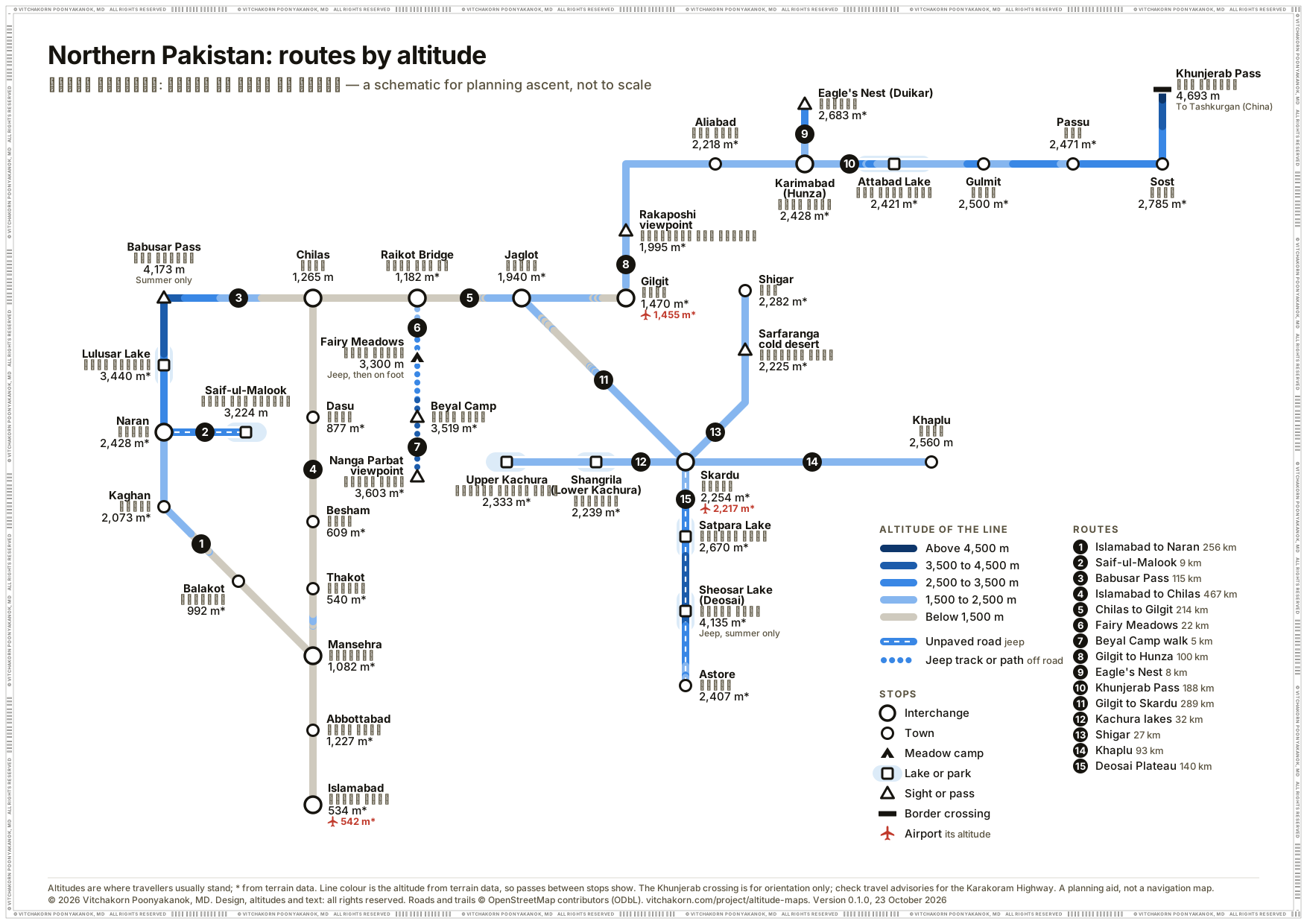
- Thirteen regions so far: Sichuan and Yunnan (106 places, 4 routes), Peru, Bolivia and Chile from Lima to the Atacama (102 places, 14 routes by road, rail and trail), Leh-Ladakh and Kashmir (62 places, 14 routes by road and trail), South Xinjiang (25 places, 9 routes), Kazakhstan and Kyrgyzstan (49 places, 24 routes by road and trail), Northern Pakistan (40 places, 15 routes), the Tajikistan Pamir Highway (28 places, 9 routes), Kilimanjaro and Meru (40 places, 8 routes on foot), the Colombian Andes (29 places, 11 routes), the Nepal Himalaya (75 places, 10 treks), the Georgian Caucasus (38 places, 13 routes by road and trail), the Colorado Rockies (30 places, 10 routes by road and rail), and Utah’s Mighty 5 and Monument Valley (22 places, 11 routes). Each has a one-page route diagram for the consult and an interactive map whose altitude profiles flag nights that climb too fast.
- My role
- Clinician: chose the places, routes and overnight stops, and set the altitudes. The geocoding, routing, web maps and route diagrams were AI-assisted.
Regions
A region’s mapAbove 4,000 m2,500 to 4,000 mPick a region to go to its card. Land from Natural Earth, relief from terrain data; no borders are drawn.
-
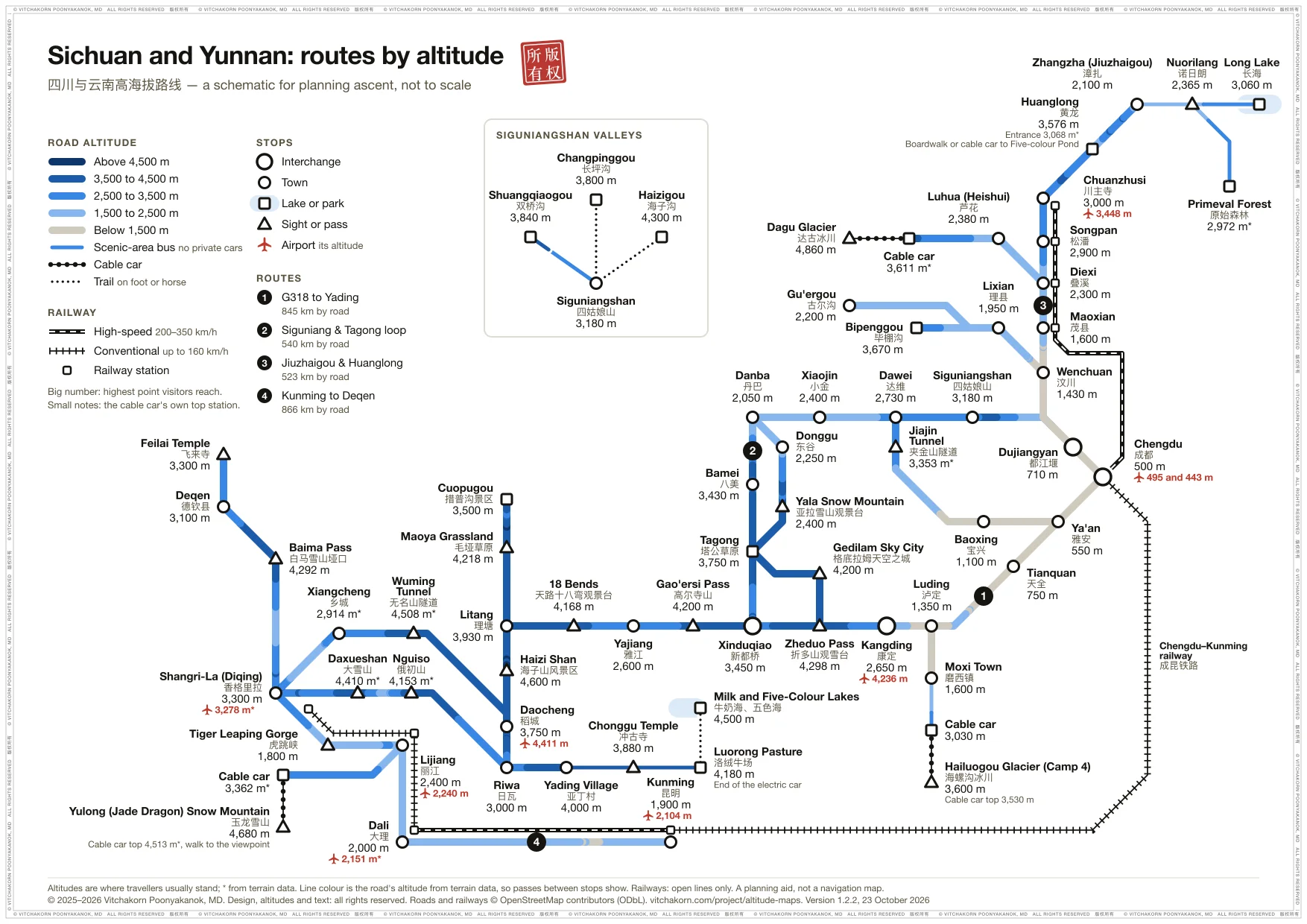
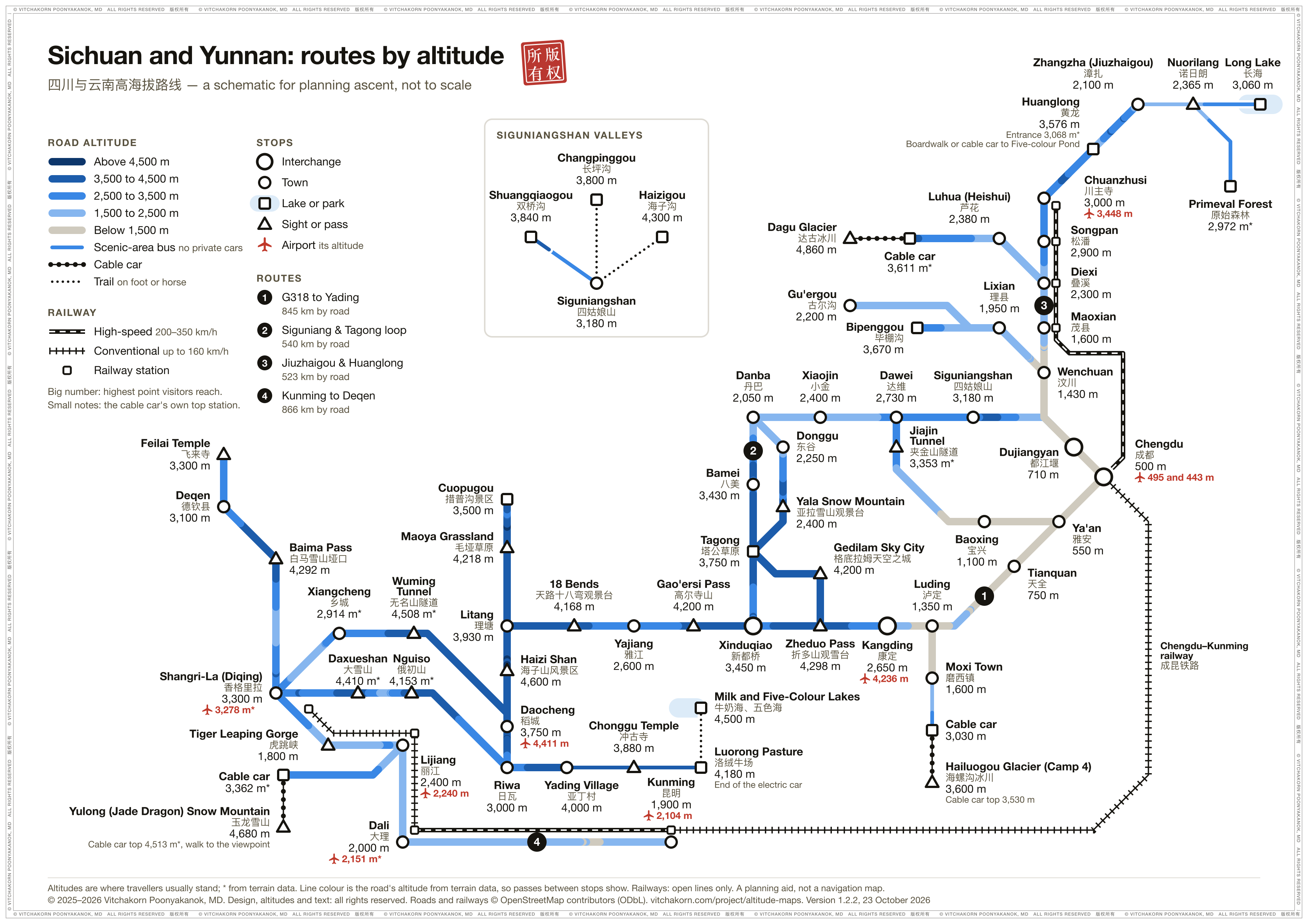
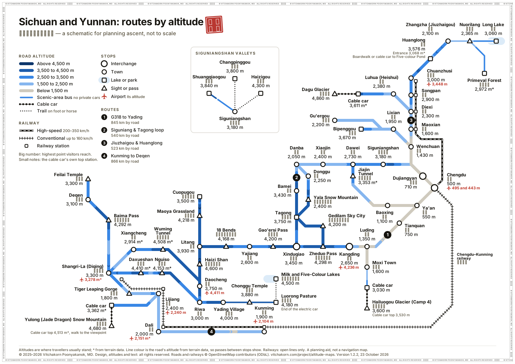
Sichuan and Yunnan
Western Sichuan and northern Yunnan: the G318 to Yading, the Siguniang and Tagong loop, Jiuzhaigou and Huanglong, and Kunming to Deqen. The places come from the hand-drawn poster.
-
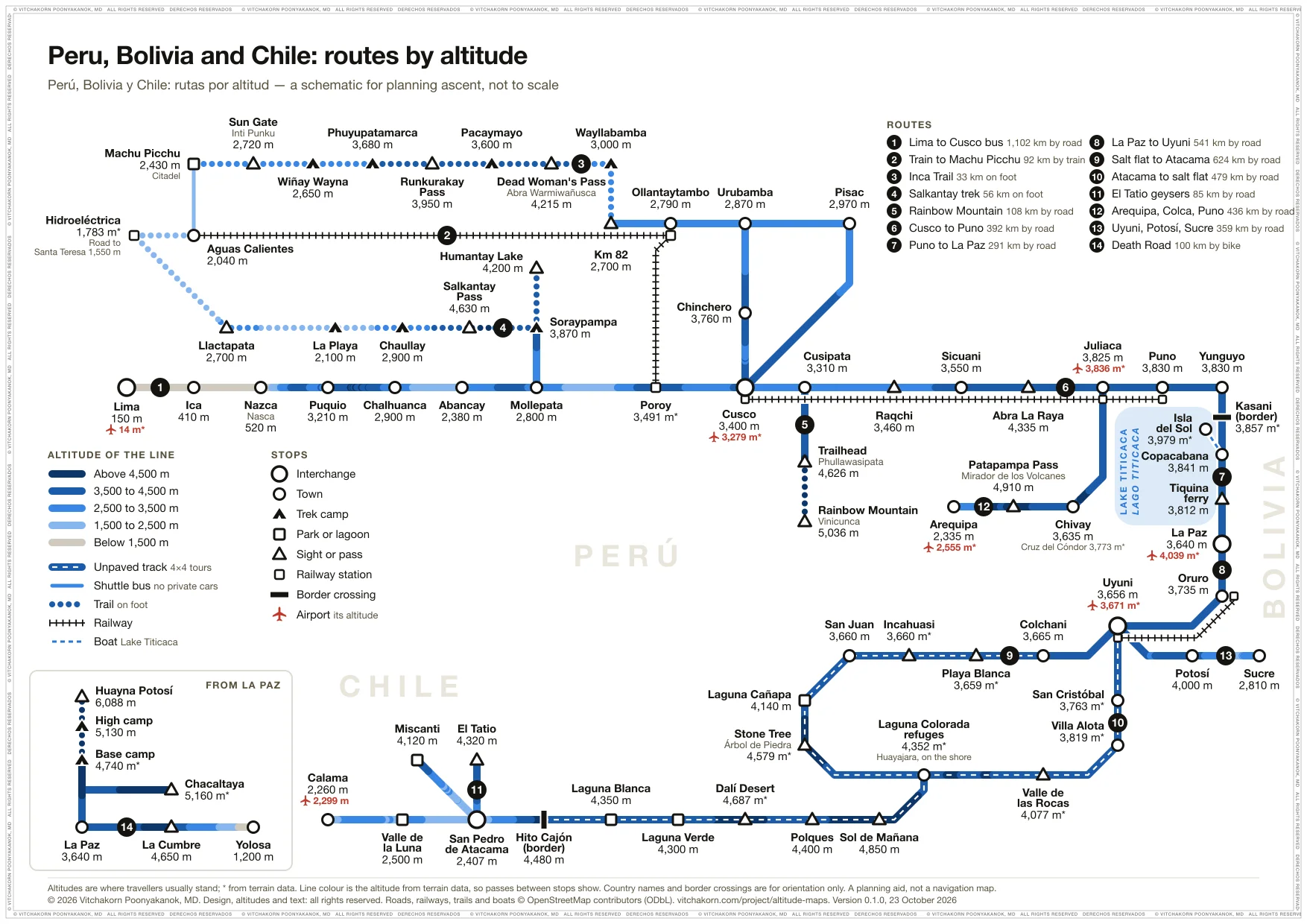
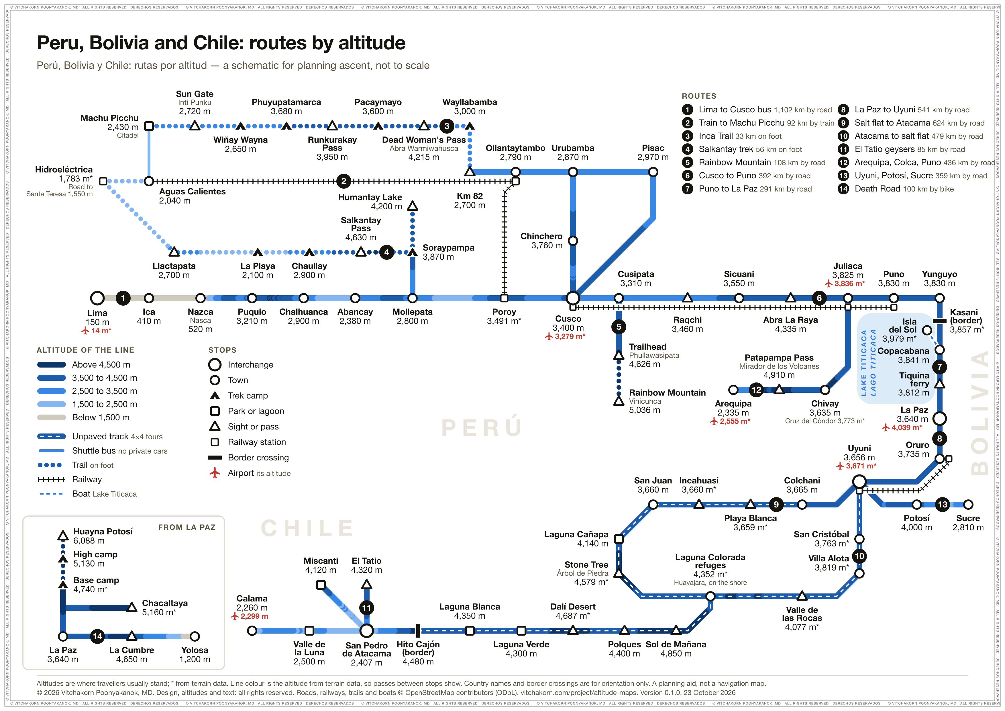
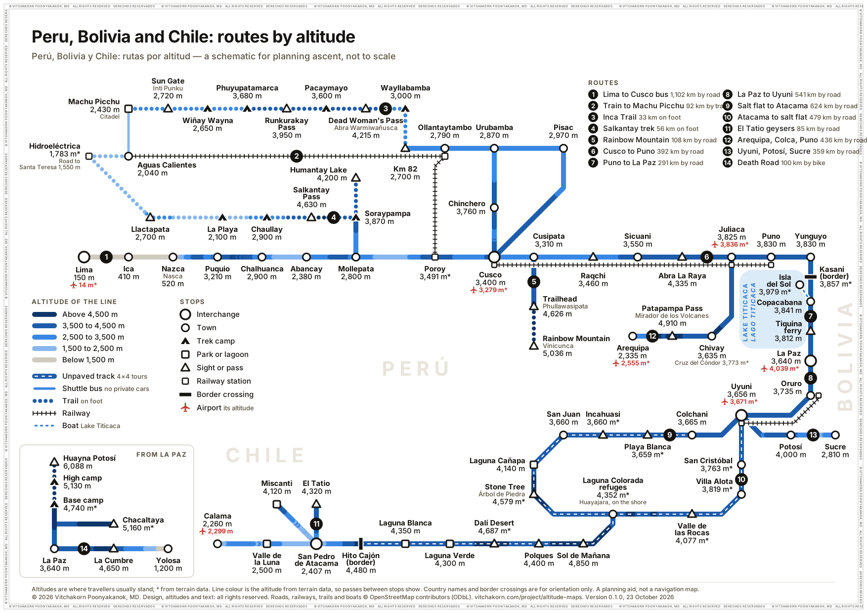
Peru, Bolivia and Chile
Lima to San Pedro de Atacama: the night bus to Cusco, the train to Machu Picchu, the Inca Trail and Salkantay treks, Rainbow Mountain, Arequipa and the Colca Canyon, Lake Titicaca, La Paz and its day trips, Potosí and Sucre, and the Uyuni salt flat.
-
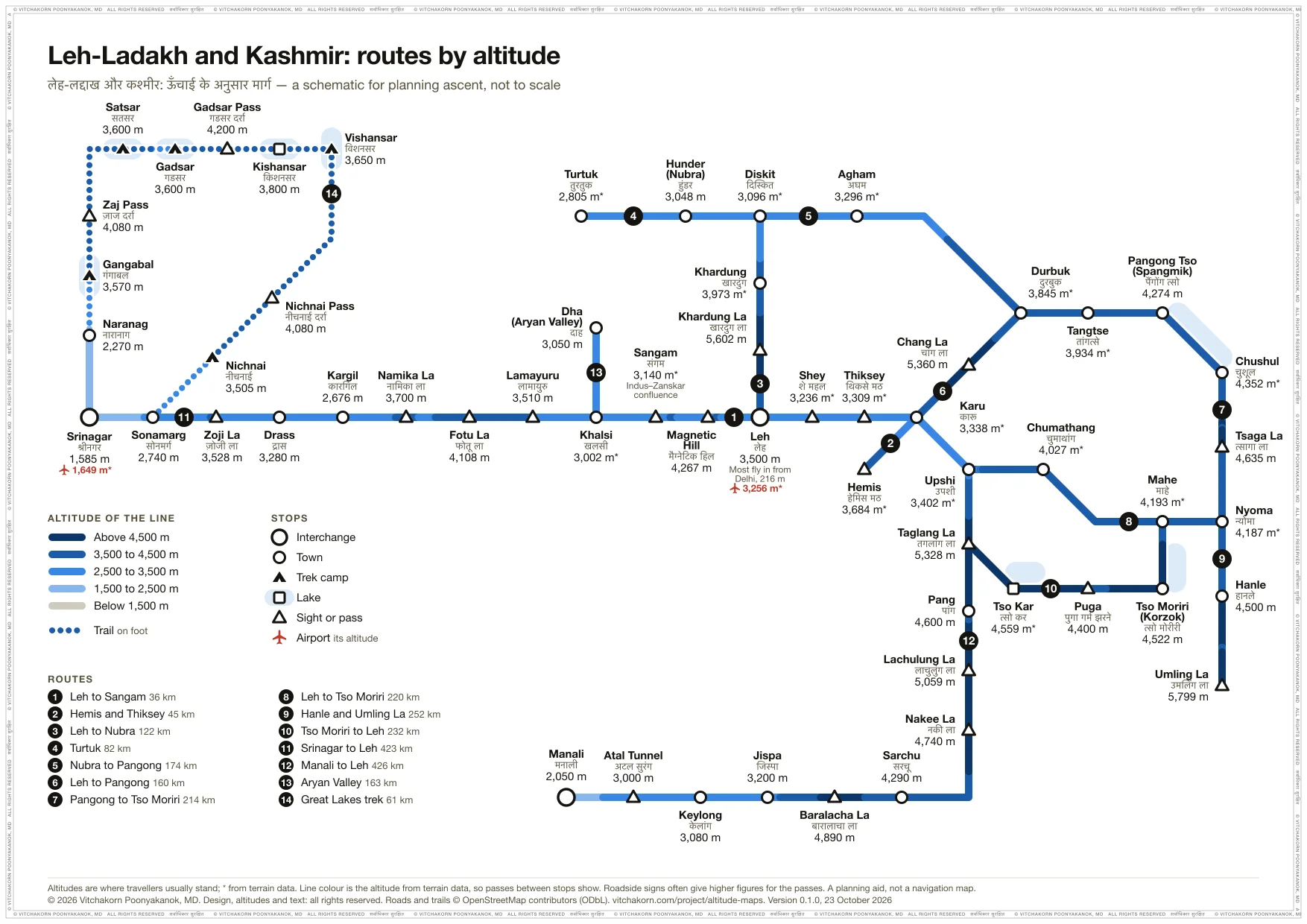
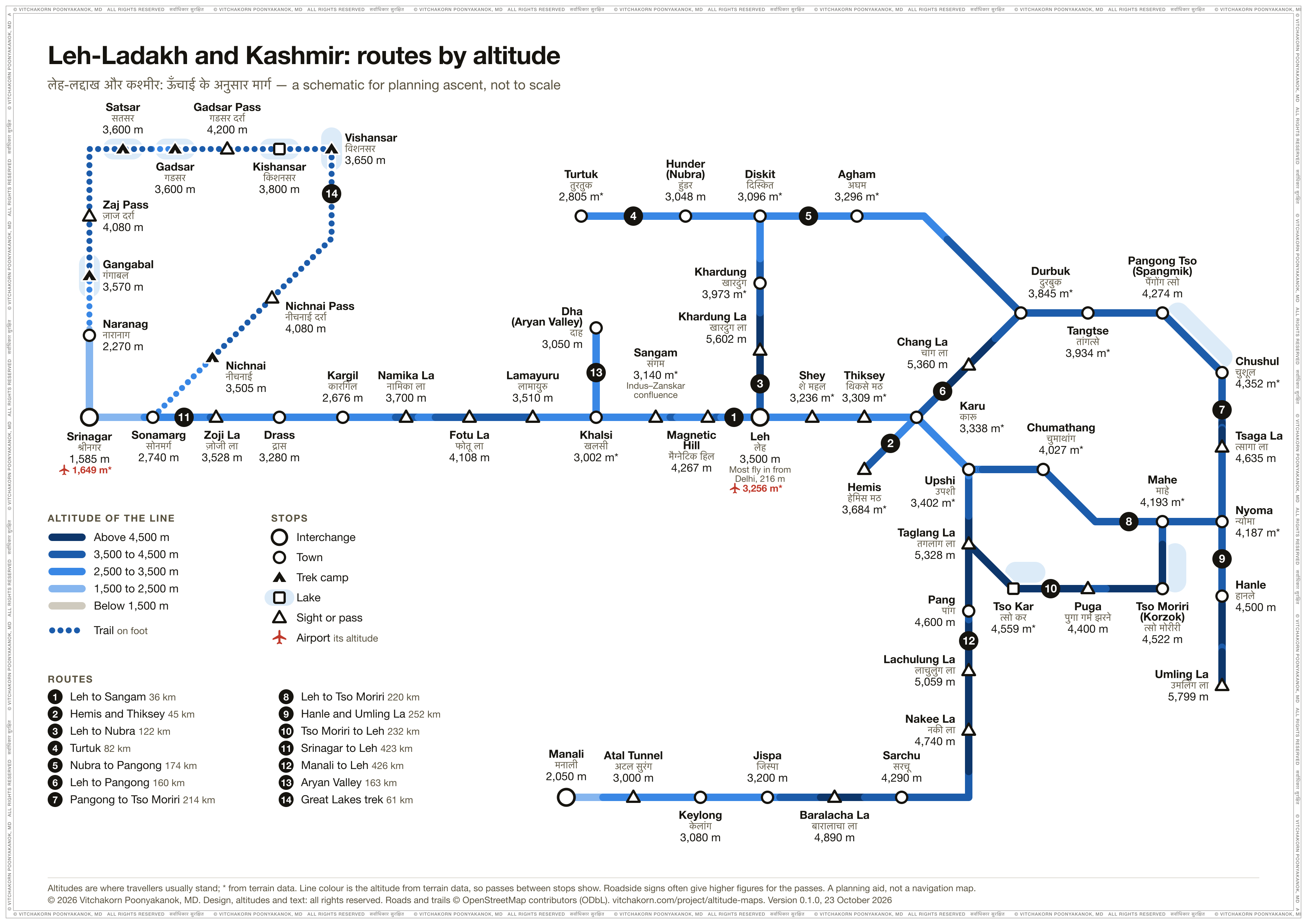
Leh-Ladakh and Kashmir
Leh, Nubra, Pangong Tso, Tso Moriri, Hanle and Umling La, the roads in from Srinagar and Manali, and the Kashmir Great Lakes trek. Most visitors fly into Leh from Delhi, 3,300 m lower, so the first nights count most.
-
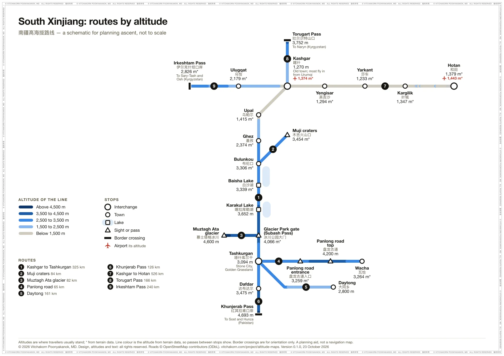
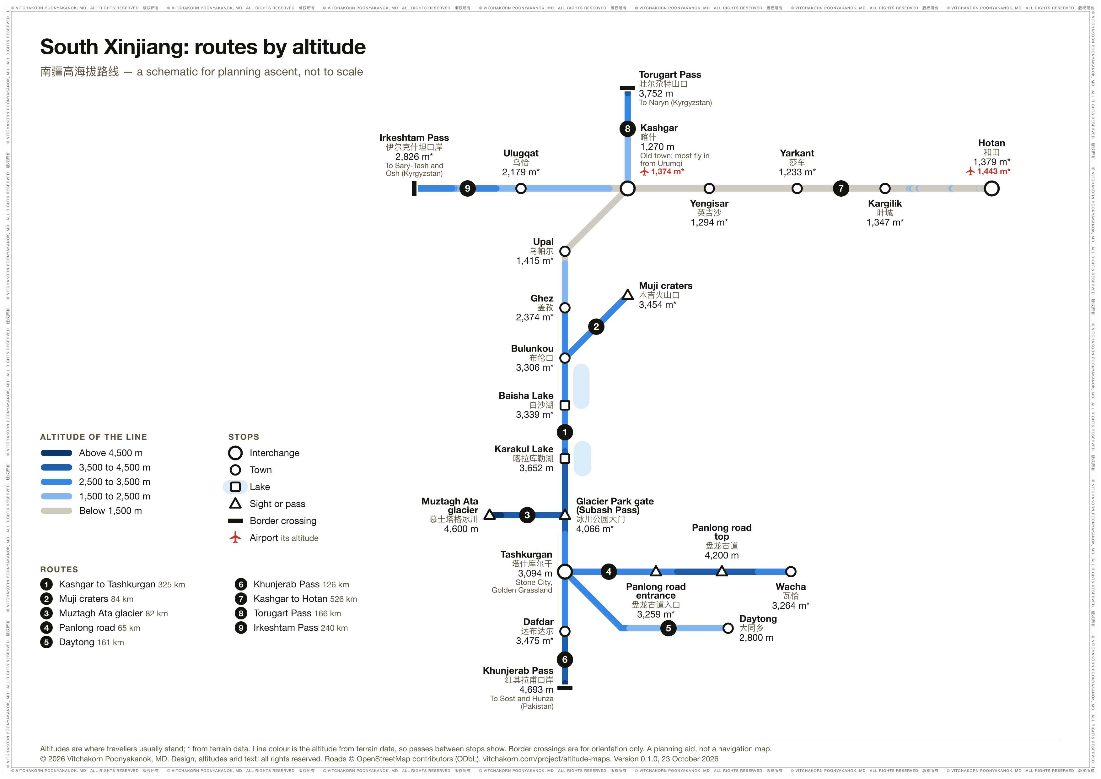
South Xinjiang
Kashgar and the Karakoram Highway past the Muji craters and Karakul Lake to Tashkurgan and the Khunjerab Pass (to Pakistan), the Muztagh Ata glacier, the Panlong Ancient Road and Daytong, Kashgar to Hotan, and the Torugart and Irkeshtam crossings into Kyrgyzstan. The highway climbs 1,800 m from Kashgar to Tashkurgan in one day.
-
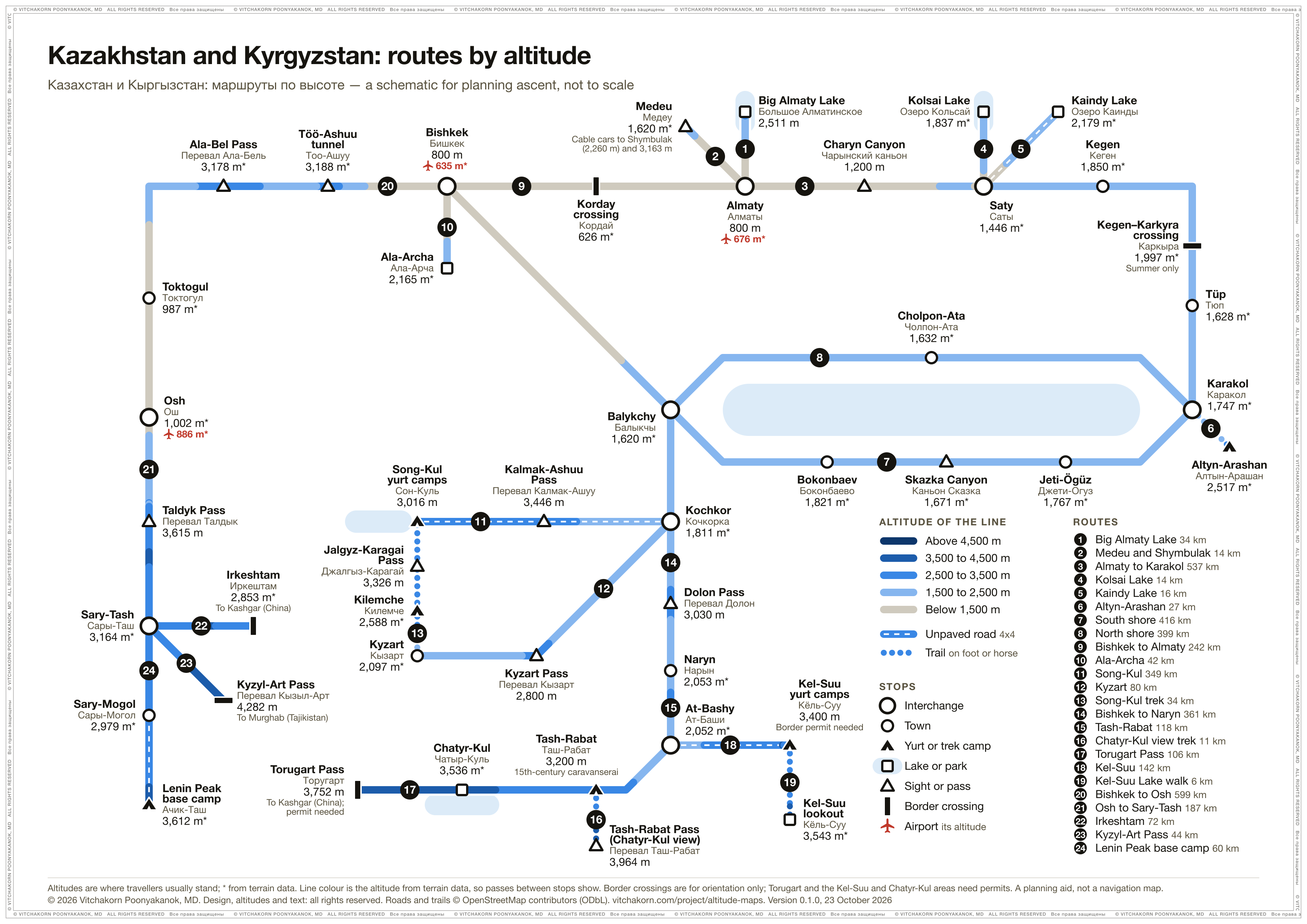
Kazakhstan and Kyrgyzstan
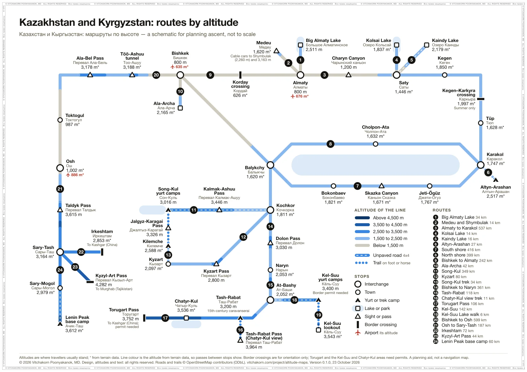
Two loops: Almaty, Shymbulak, Charyn and Kolsai to Karakol and Altyn-Arashan, and round Issyk-Kul to Bishkek; and the south, from Song-Kul and Naryn to Tash-Rabat, Kel-Suu and the Torugart pass, and from Osh over the Taldyk pass to Sary-Tash. Torugart and Irkeshtam lead on to South Xinjiang, and Kyzyl-Art to the Pamir Highway in Tajikistan.
-
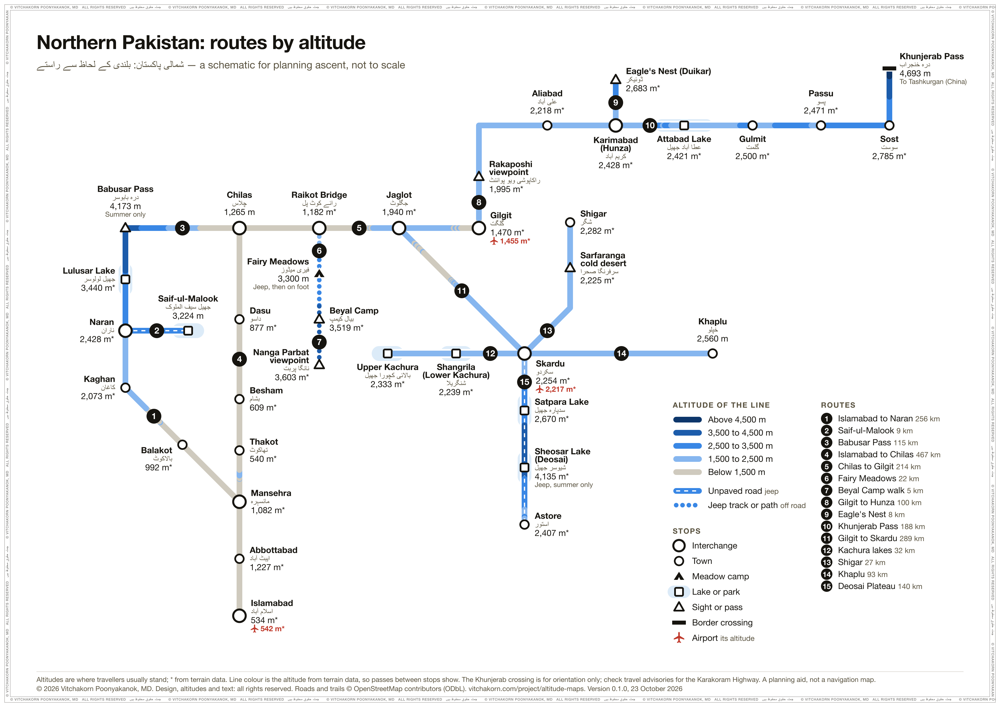
Northern Pakistan
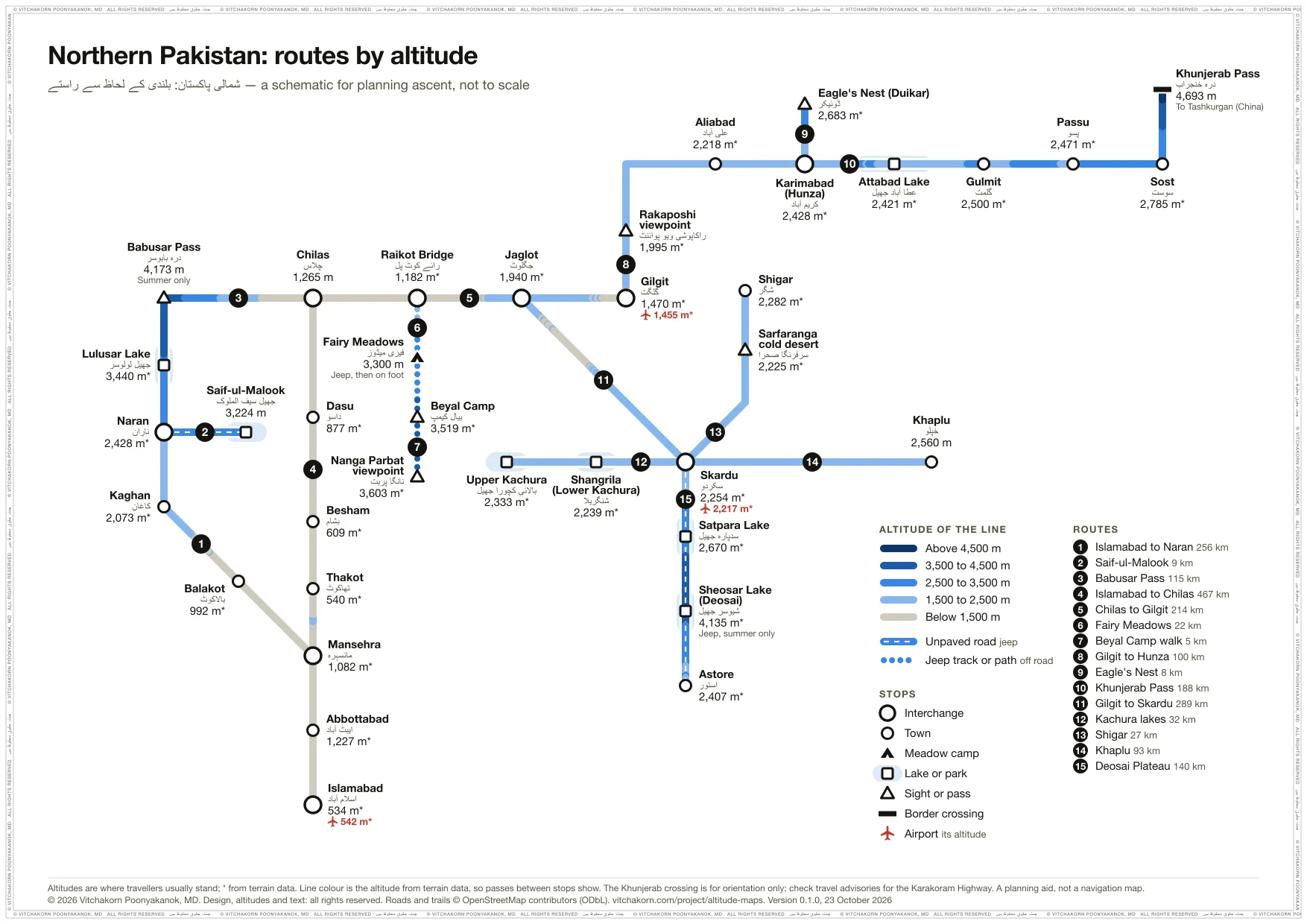
The Karakoram Highway from Islamabad to Gilgit, Hunza and the Khunjerab Pass, Naran and the Babusar Pass, Fairy Meadows below Nanga Parbat, and Skardu, Shigar, Khaplu and the Deosai Plateau. Fairy Meadows sleeps 2,000 m above Chilas. Khunjerab leads on to South Xinjiang.
-
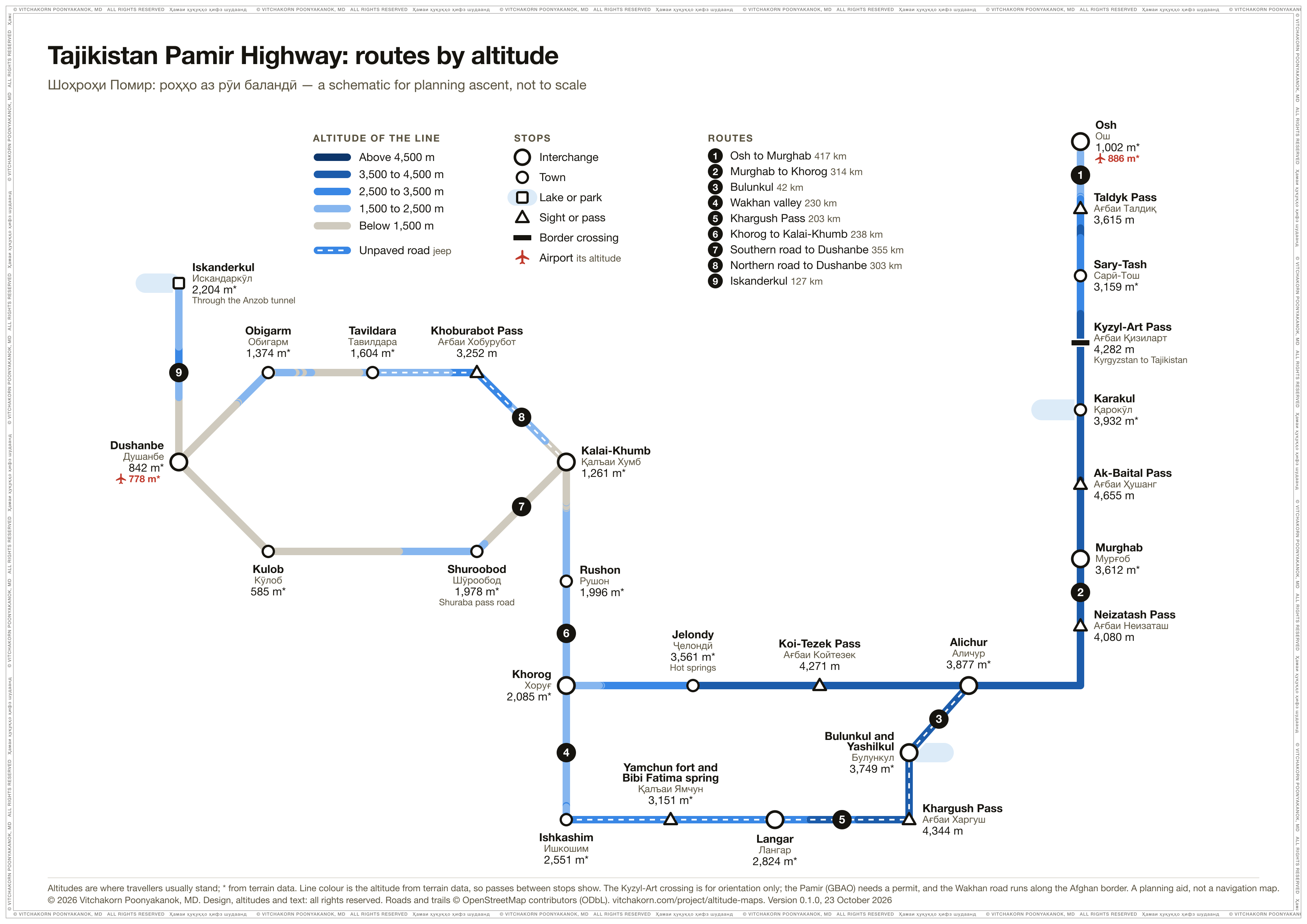
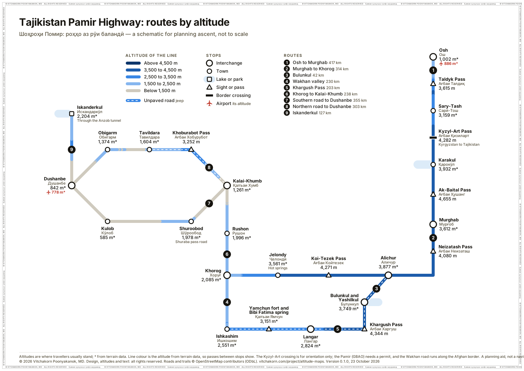
Tajikistan Pamir Highway
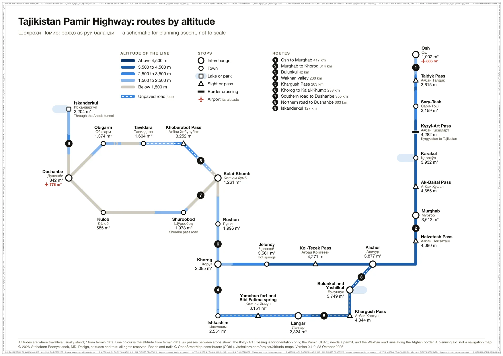
The Pamir Highway from Osh over the Kyzyl-Art and Ak-Baital passes to Murghab, Alichur, Bulunkul and Khorog, the Wakhan valley and the Khargush pass, and the roads to Dushanbe and Iskanderkul. Most tours sleep in Murghab the night after Osh, 2,600 m higher. Kyzyl-Art leads back to Kazakhstan and Kyrgyzstan.
-
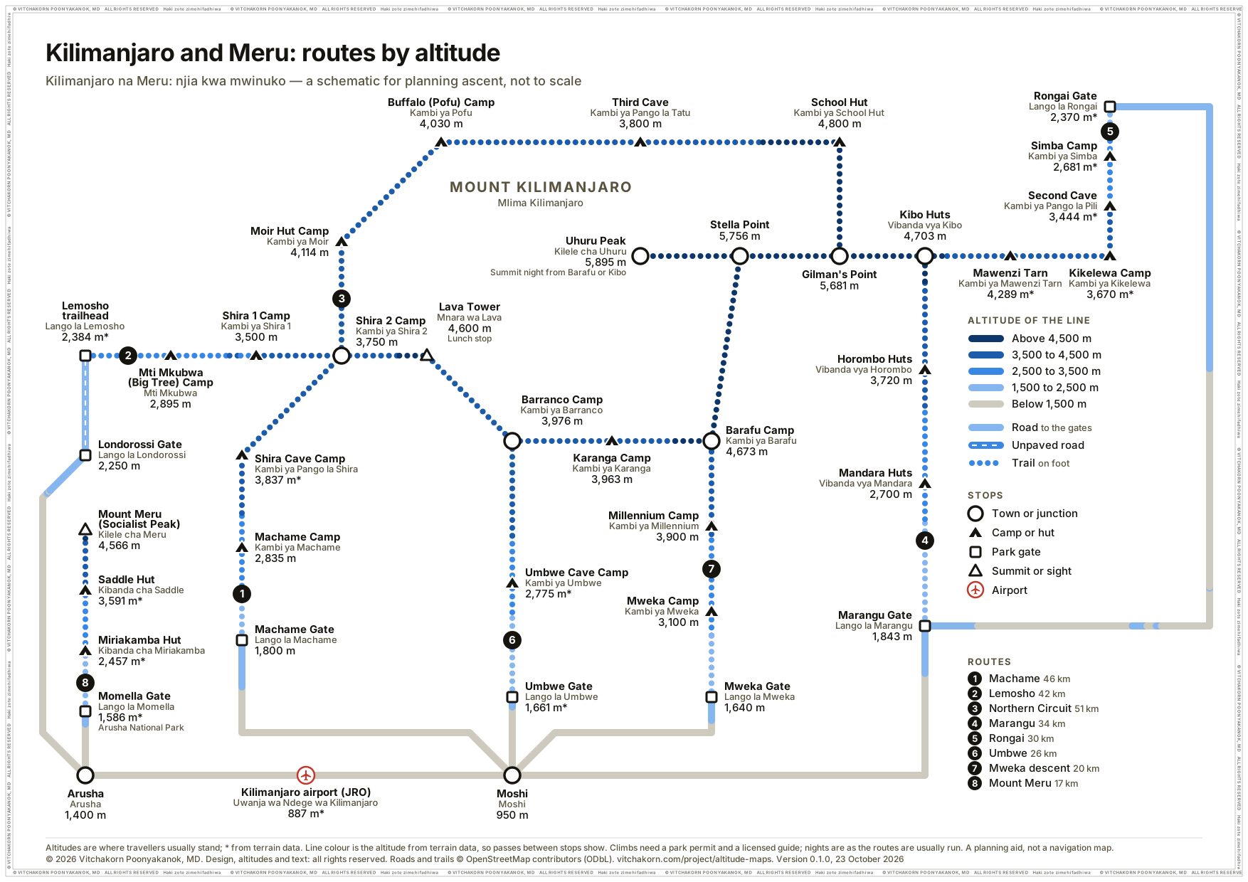
Kilimanjaro and Meru
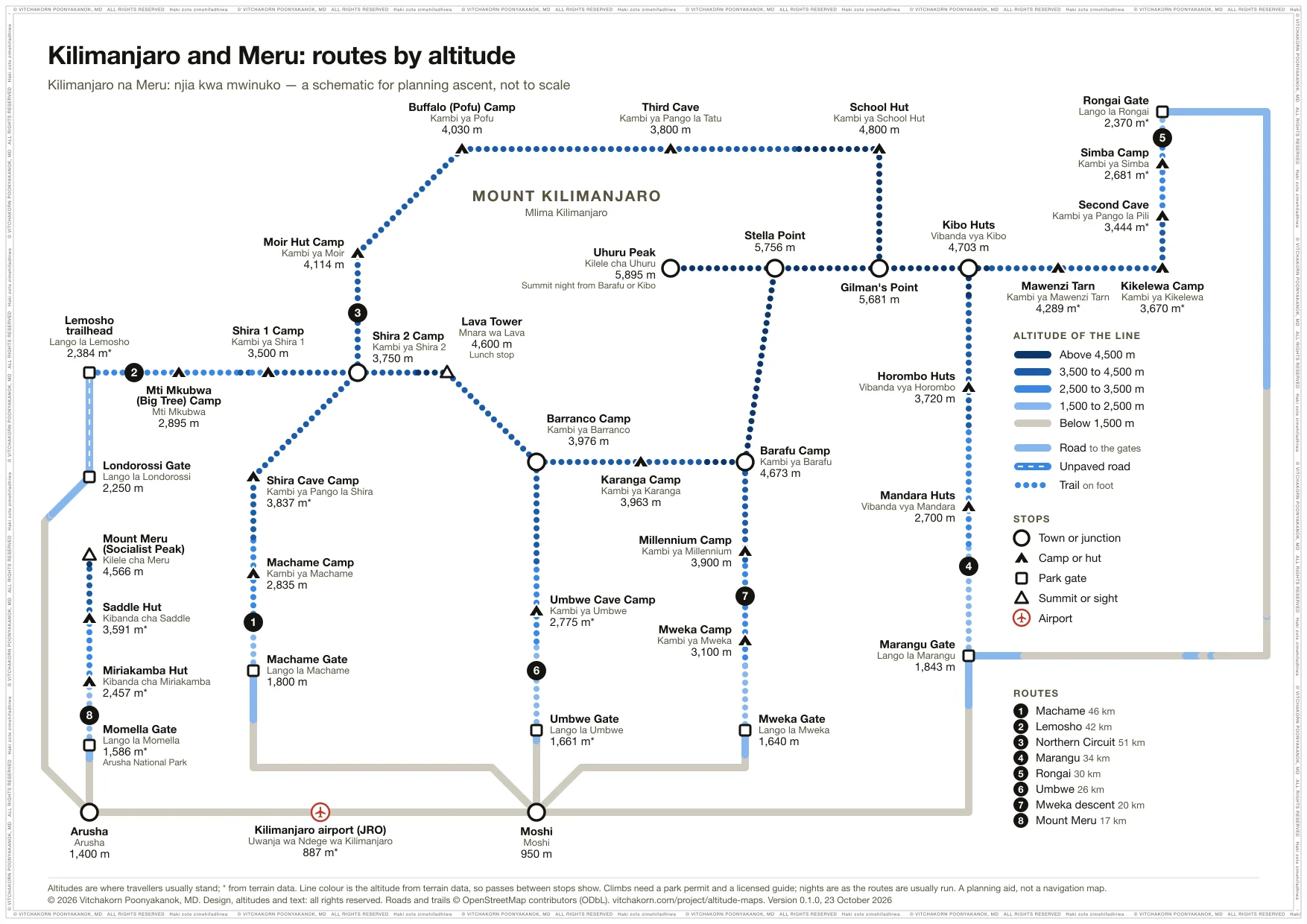
The Machame, Lemosho, Northern Circuit, Marangu, Rongai and Umbwe routes to Uhuru Peak, the Mweka descent, and Mount Meru, the usual acclimatisation climb. The first night on most routes is already 1,800 to 2,000 m above Moshi, and the summit night climbs 1,200 m.
-
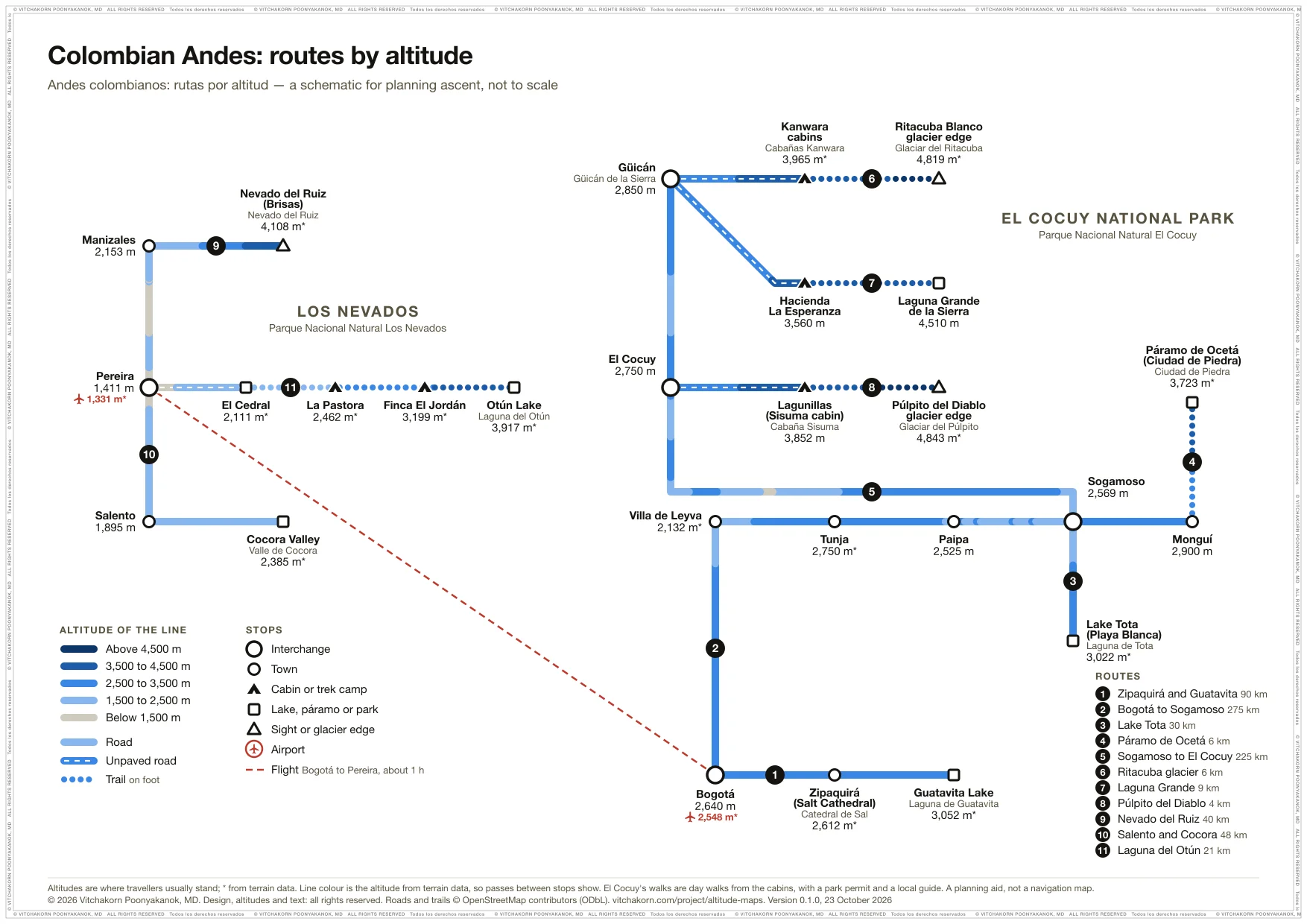
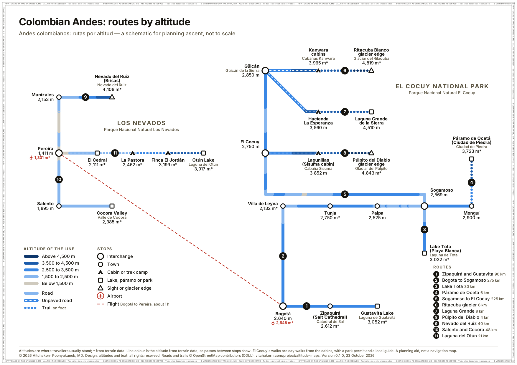
Colombian Andes
Bogotá and Boyacá, Lake Tota and the Páramo de Ocetá, the three day walks of El Cocuy National Park to the glacier edge and Laguna Grande de la Sierra, and Los Nevados: Nevado del Ruiz, Salento and Cocora, and the Laguna del Otún trek. The El Cocuy cabins sleep up to 1,100 m above the town the night before.
-
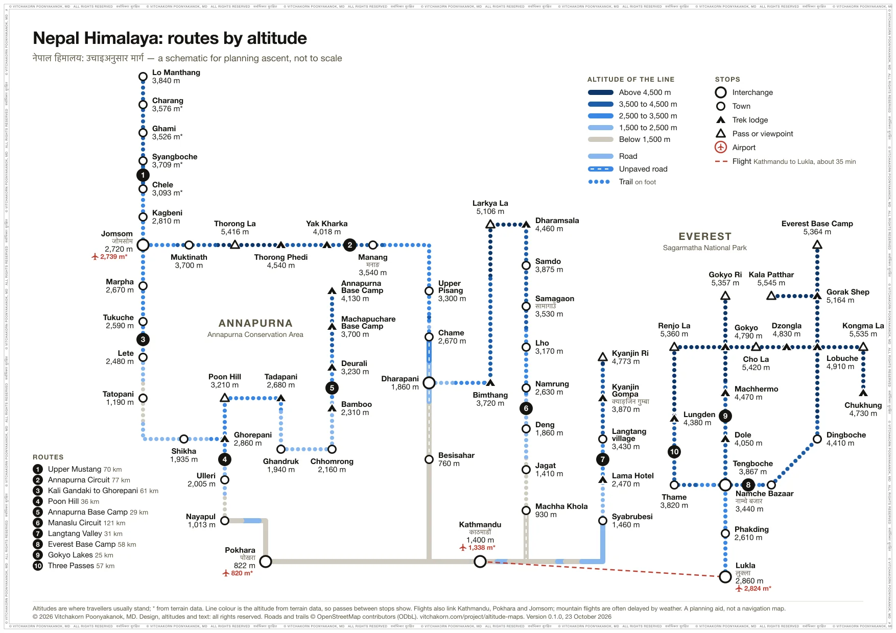
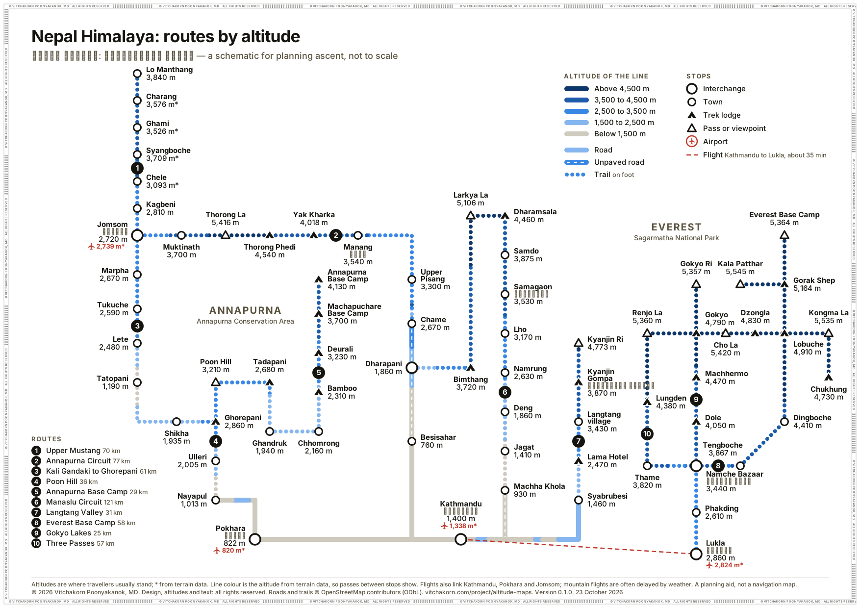
Nepal Himalaya
Everest Base Camp, the Gokyo Lakes and the Three Passes in the Khumbu, the Annapurna Circuit with its classic finish down the Kali Gandaki, Annapurna Base Camp and Poon Hill, Upper Mustang, the Manaslu Circuit and the Langtang Valley, with the roads and flights to their trailheads. The first nights above 3,000 m often climb more than 500 m, at Namche Bazaar, Deurali, Samagaon and Langtang village.
-
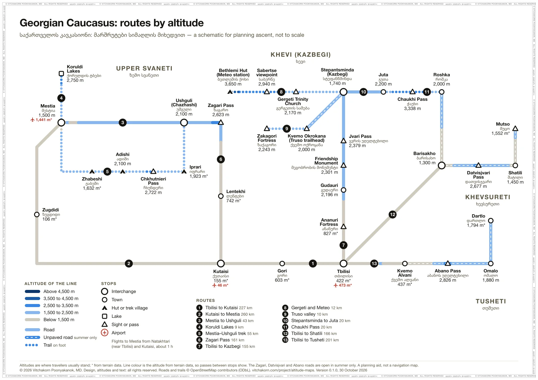
Georgian Caucasus
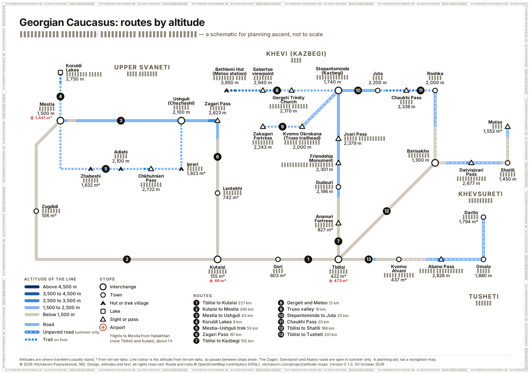
The road from Tbilisi over the Jvari Pass to Stepantsminda (Kazbegi), with Gergeti, the Truso valley, Juta and the Chaukhi Pass; Khevsureti and Shatili; Tusheti over the Abano Pass; and Upper Svaneti: Mestia, Ushguli, the Mestia–Ushguli trek and the Zagari Pass. Most nights are below 2,500 m; the Bethlemi Hut on the Kazbek climb sleeps 1,900 m above Stepantsminda.
-
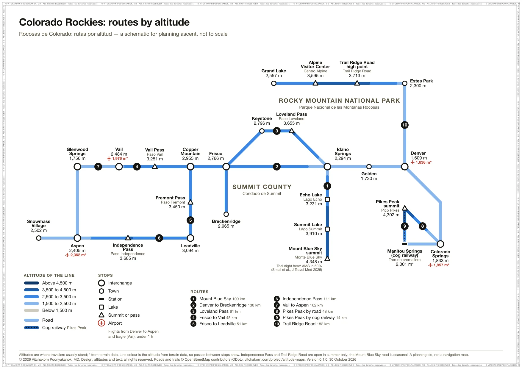
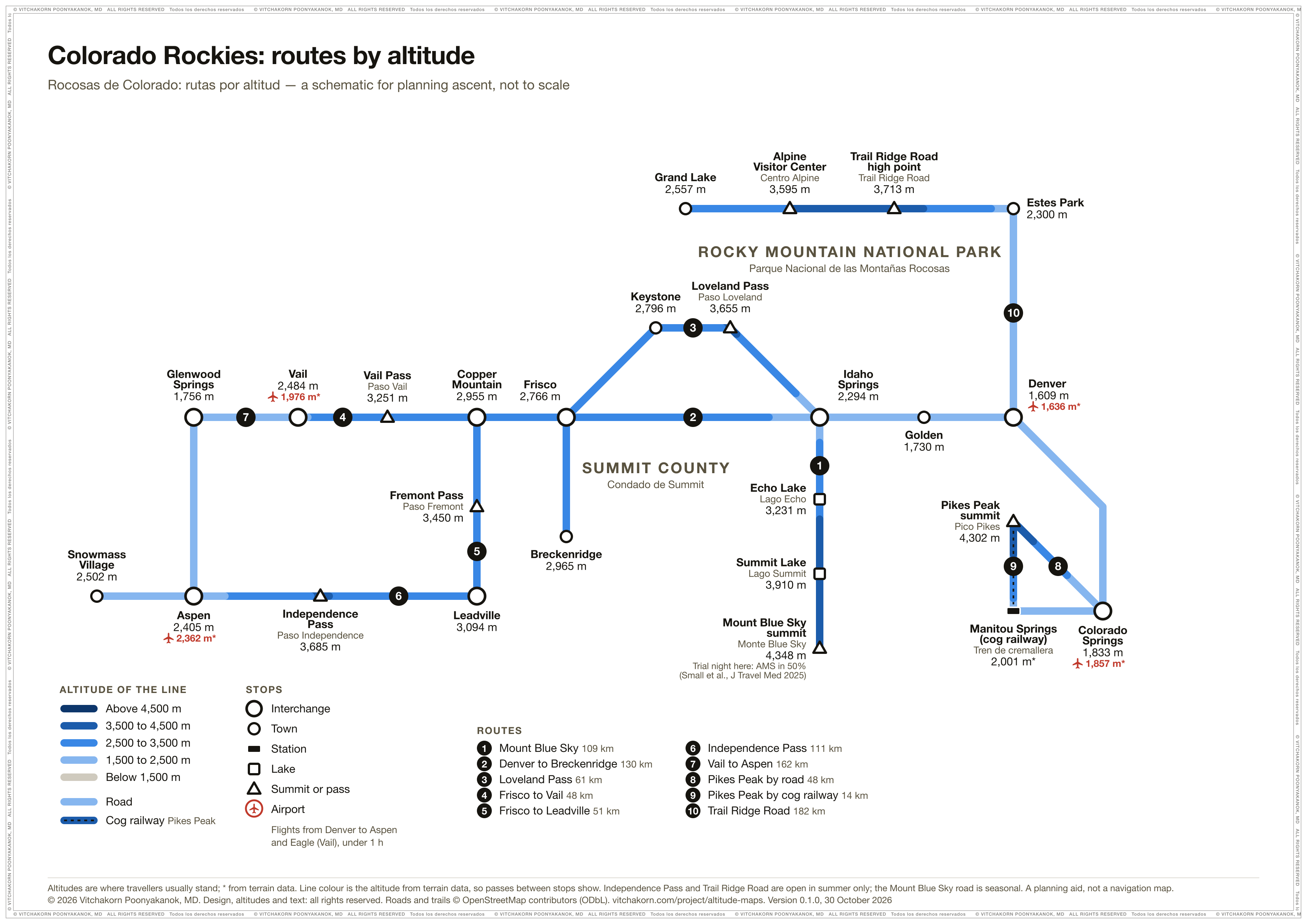
Colorado Rockies
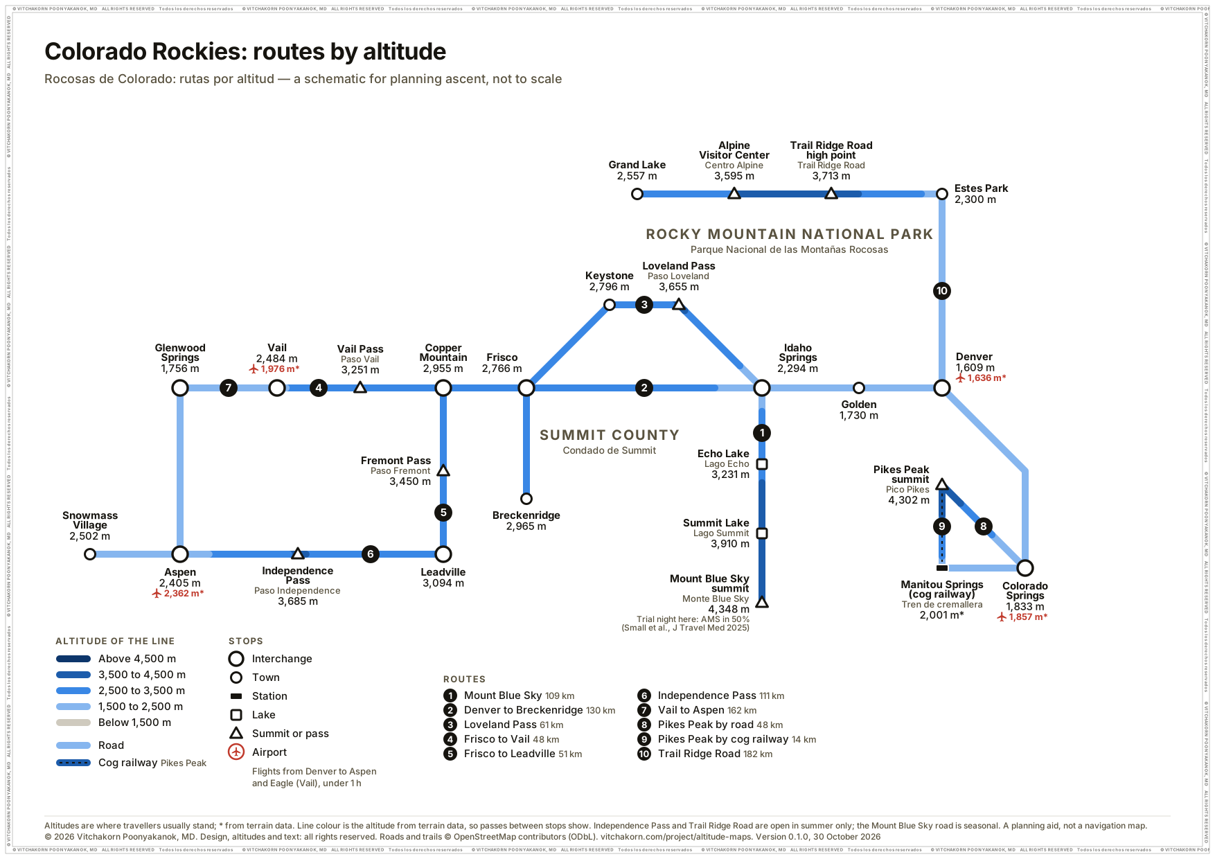
Denver to the Summit County ski towns by I-70 or the Loveland Pass, Vail, Leadville and Aspen over the Vail, Fremont and Independence passes, Pikes Peak by road and cog railway, Trail Ridge Road, and the road to the summit of Mount Blue Sky, where a 2025 trial of prochlorperazine slept 2,700 m above Denver. A first night in Breckenridge or Keystone straight from Denver is 1,200 to 1,400 m higher.
-
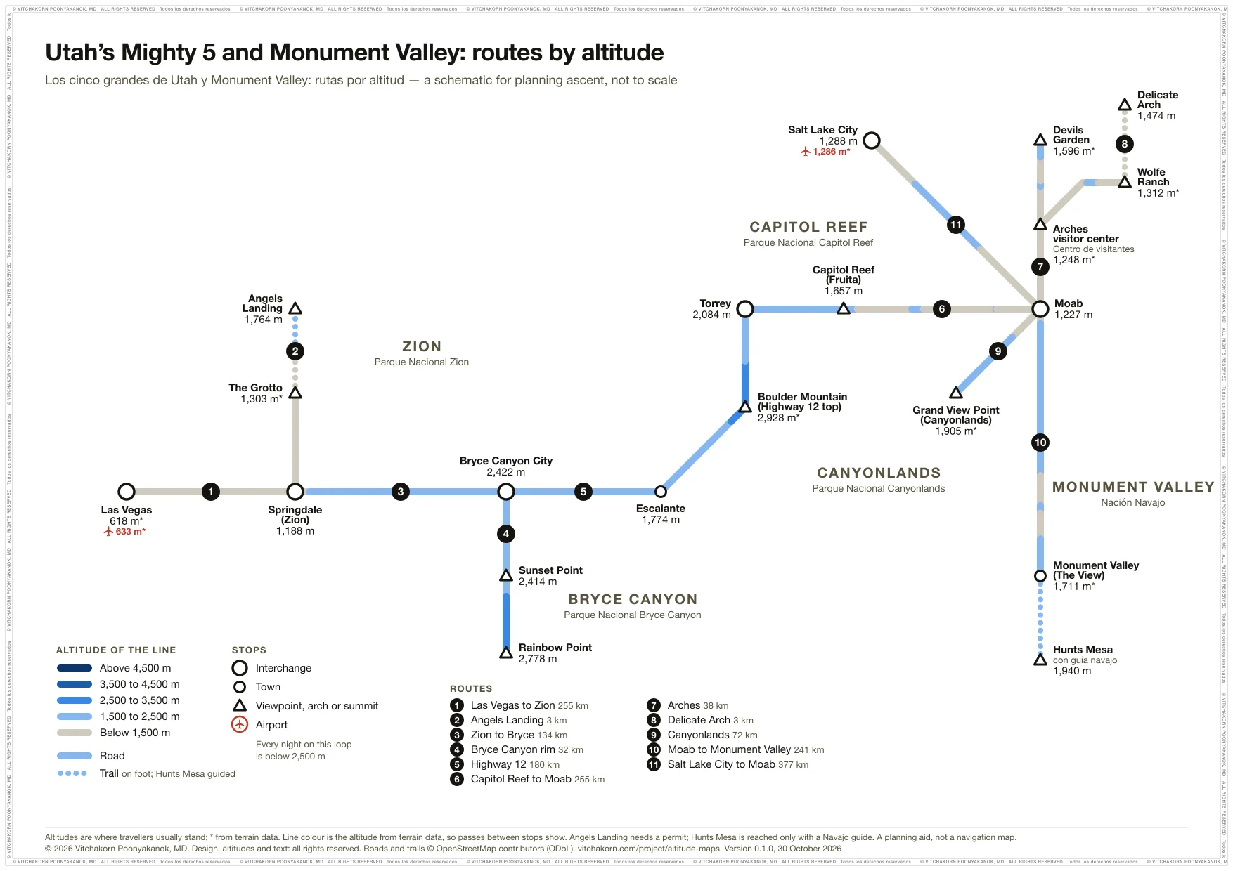
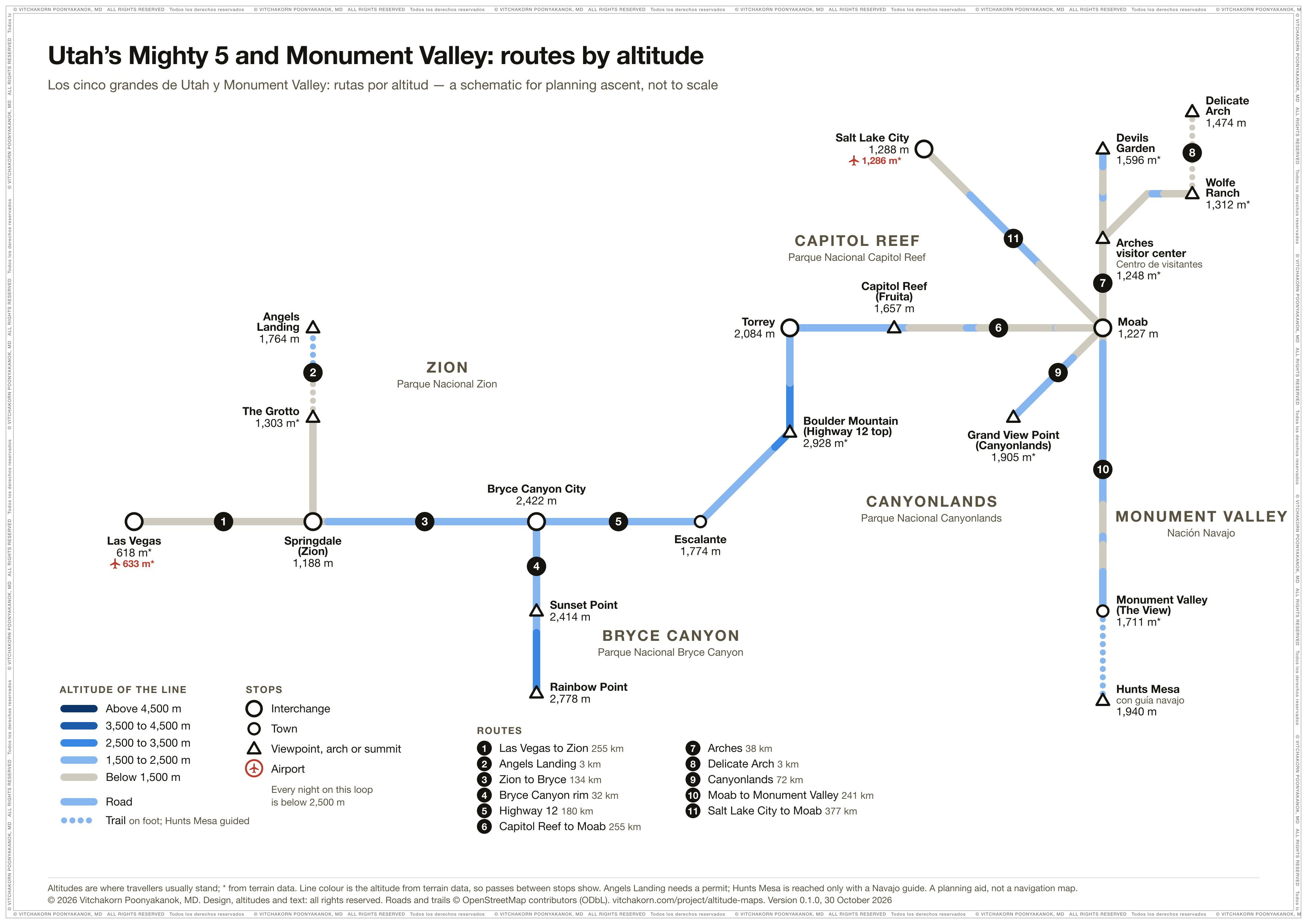
Utah’s Mighty 5 and Monument Valley
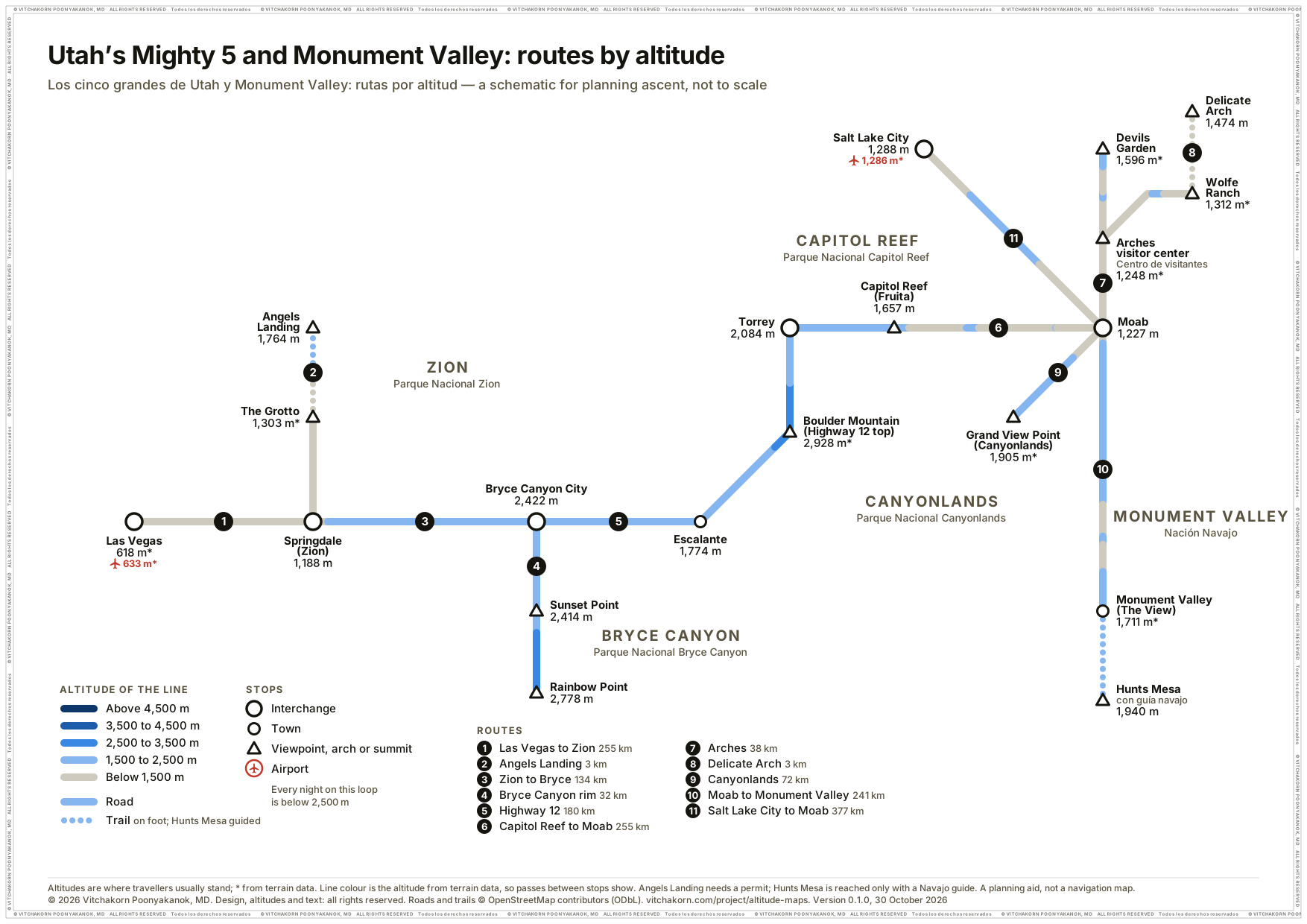
Zion and Angels Landing, Bryce Canyon to Rainbow Point, Highway 12 over Boulder Mountain, Capitol Reef, Arches and Delicate Arch, Canyonlands, and Monument Valley with Hunts Mesa, from Las Vegas or Salt Lake City. Every night is below 2,500 m; only the Bryce rim and Boulder Mountain, by day, climb above it.
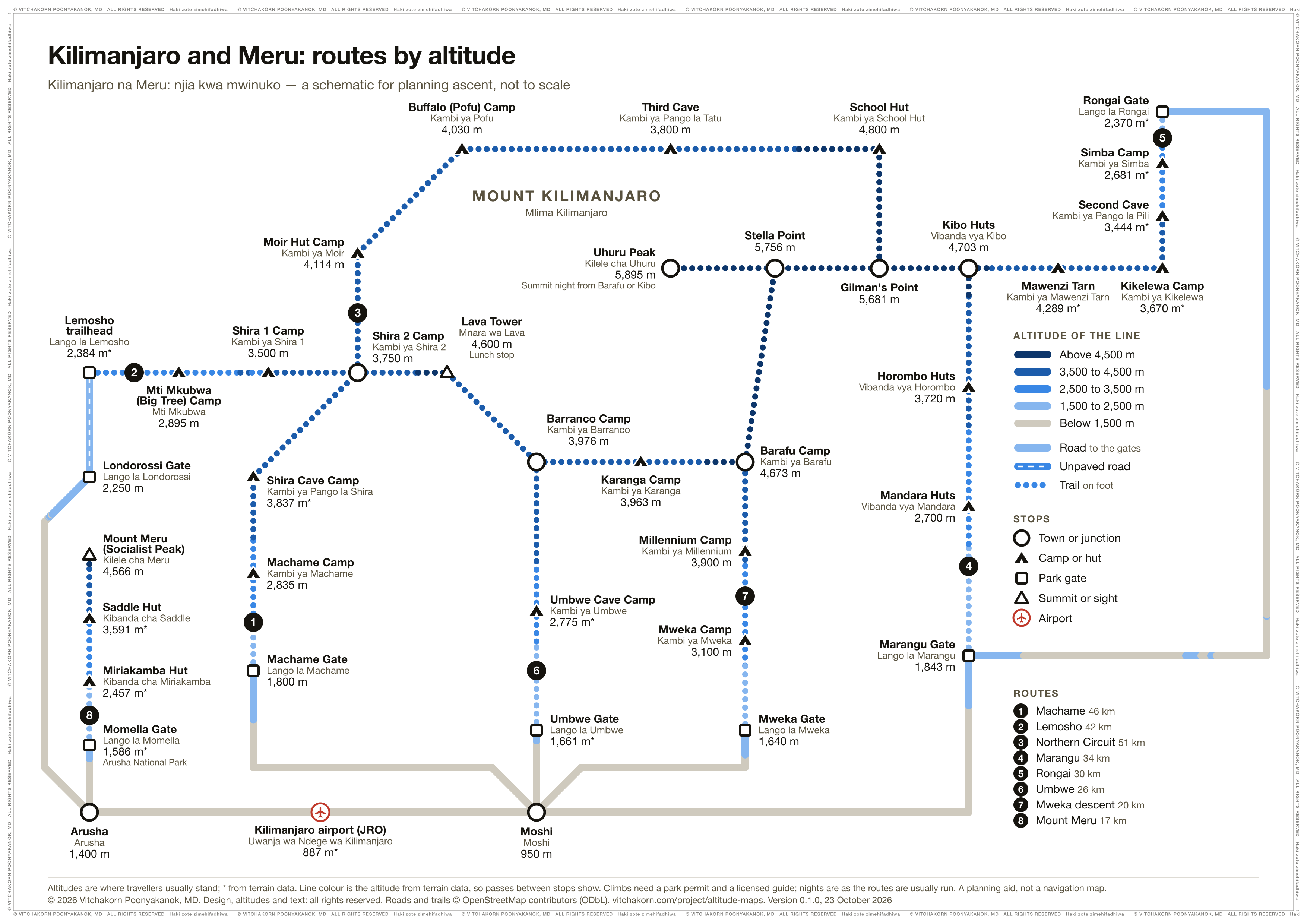
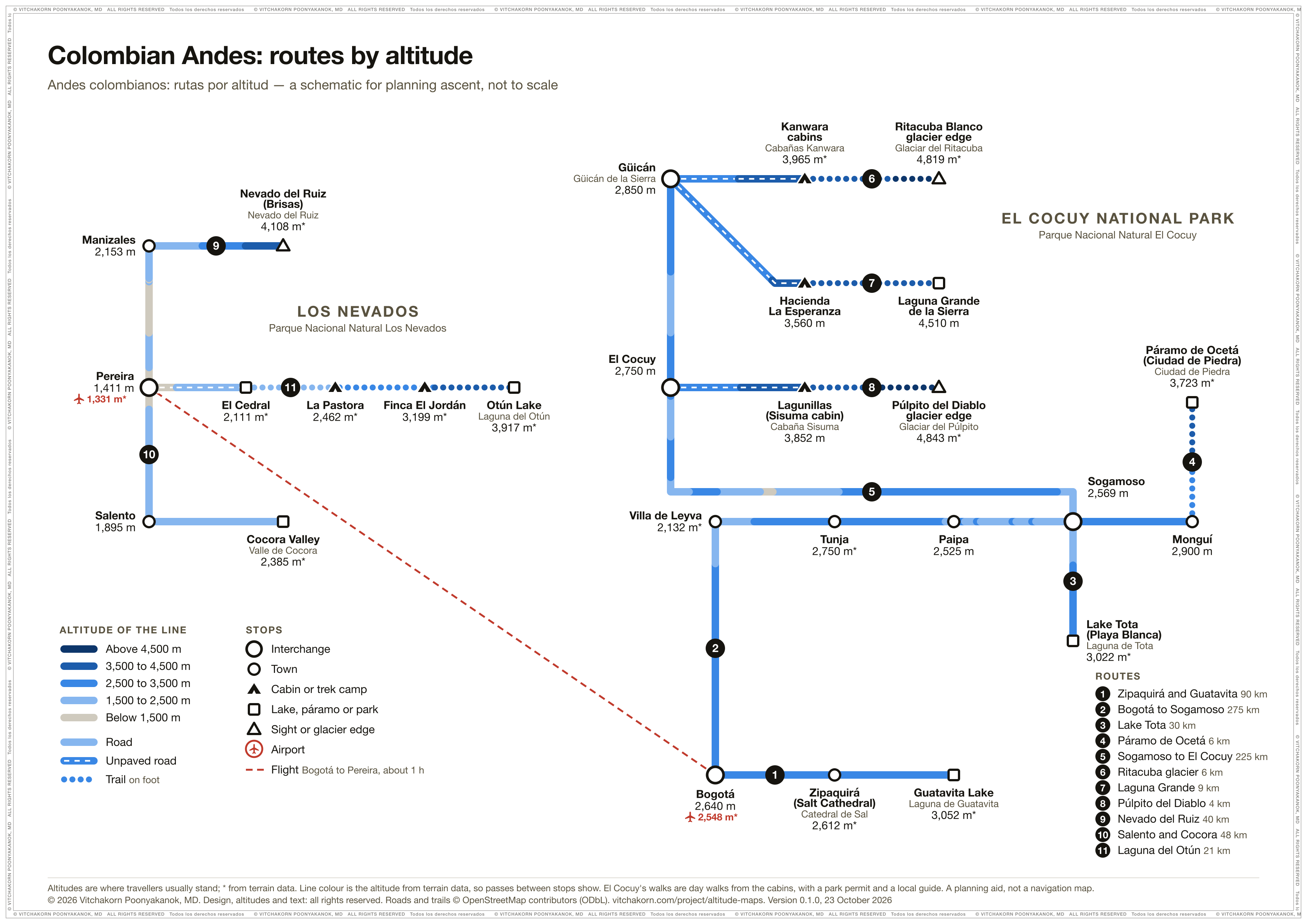
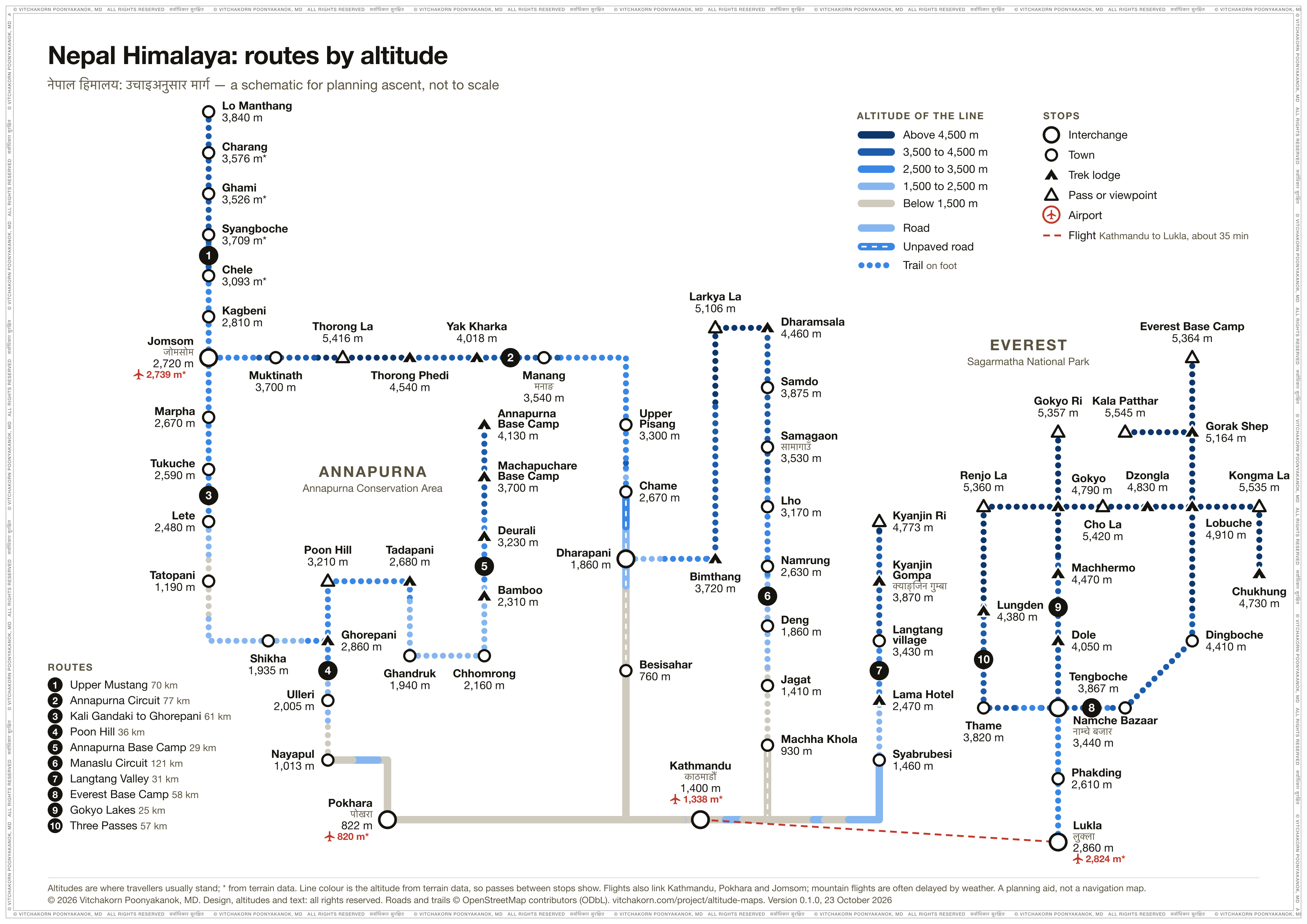
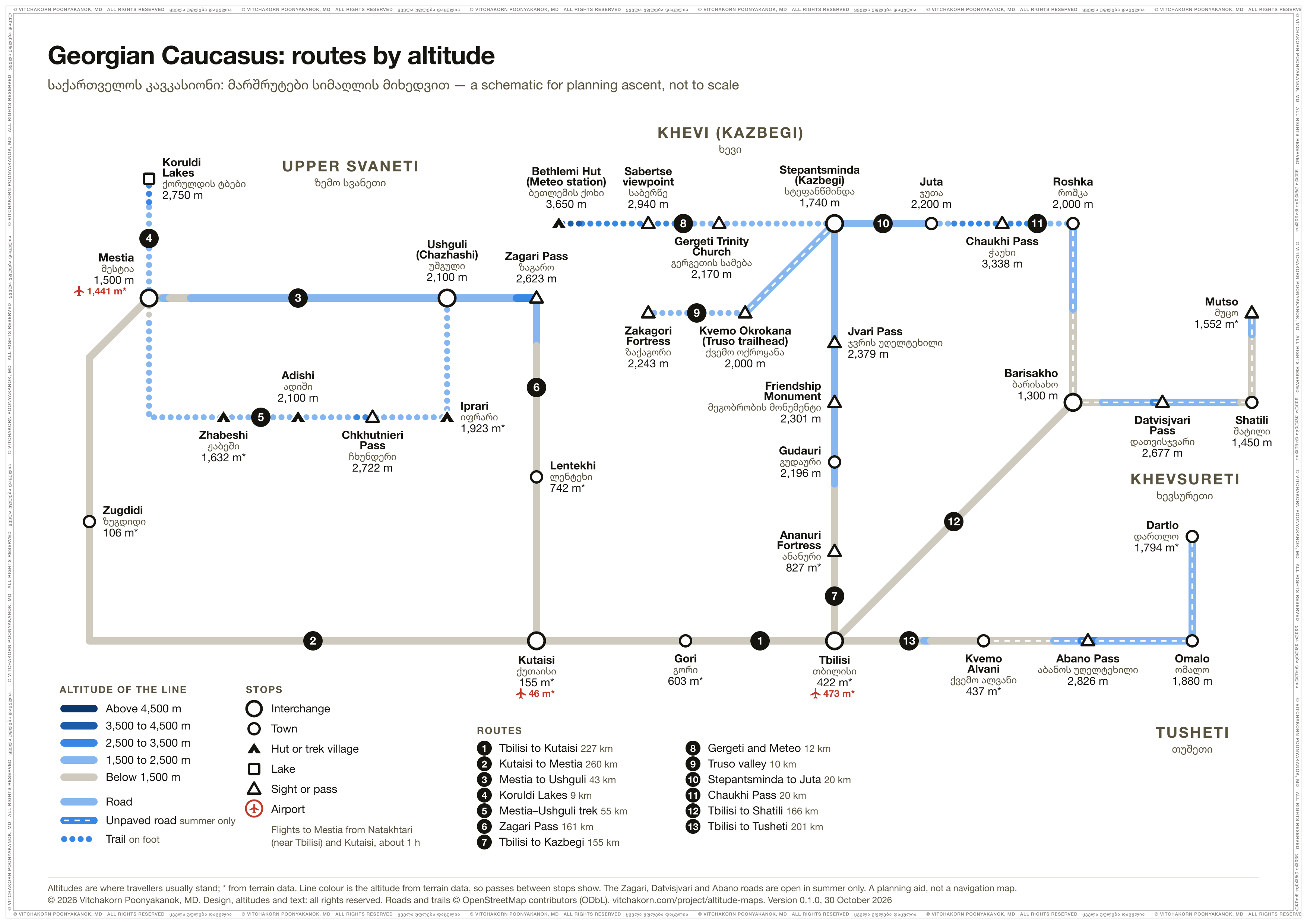
Problem
High-altitude trips are planned night by night, but guidebooks, tour operators and maps give altitudes one place at a time, in two languages, and often for the summit rather than the point people reach. Advising a traveller means knowing where each night is spent and how high. The night bus from Lima arrives in Cusco 3,250 m above the night before. A Colca Canyon tour from Arequipa crosses a 4,910 m pass and sleeps 1,300 m higher. The G318 to Yading climbs over passes above 4,500 m. None of that shows on a map that lists places one by one.
Approach
Each region starts as a list of places with the altitude travellers reach and its source. Sichuan and Yunnan’s list was read from the labels of a hand-drawn poster; Peru, Bolivia and Chile’s started as data. Each place is matched to OpenStreetMap and its altitude checked against terrain data. Where a lake, reserve or peak stands in for the shore, trailhead or viewpoint travellers reach, the marker is flagged as approximate. Roads are routed by OSRM, and railways and treks follow their mapped OpenStreetMap paths. All of them are sampled for altitude every 250 to 500 m, with roads capped at a road-like grade so a tunnel doesn’t read as the mountain above it. Passes land within 10 m of their signposted heights (Zheduo 4,289 against 4,298 m).
Each itinerary lists where people sleep, so a night bus or a tour van is judged by its nights, not by every town it passes; in Sichuan and Yunnan, every town on a route counts as a possible night. The same data drives the interactive map, its altitude profiles and the route diagram. Each diagram’s stops are hand-placed on a metro-style grid, and its build checks every label against the others and against every line, and lists any overlap. One shared pipeline builds every region, so a new region is a new place list and a new layout.
Outcome
A clinical reference for walking a traveller through a whole itinerary: where they will sleep, how high, and which nights climb too fast. The interactive maps work in 2D or with 3D terrain, filter by place type, and follow a route’s profile on the map as you move along the chart. The view and route are kept in the link, so a clinician can send a patient straight to their route. The route diagram prints on one A4 page for the consult.