Sichuan-Yunnan Altitude & Transit Map
A single bilingual reference map covering western Sichuan and northern Yunnan, combining altitude, attractions, towns, and transit infrastructure in one view — built to make a high-altitude travel-medicine consult faster than flipping between several regional maps.
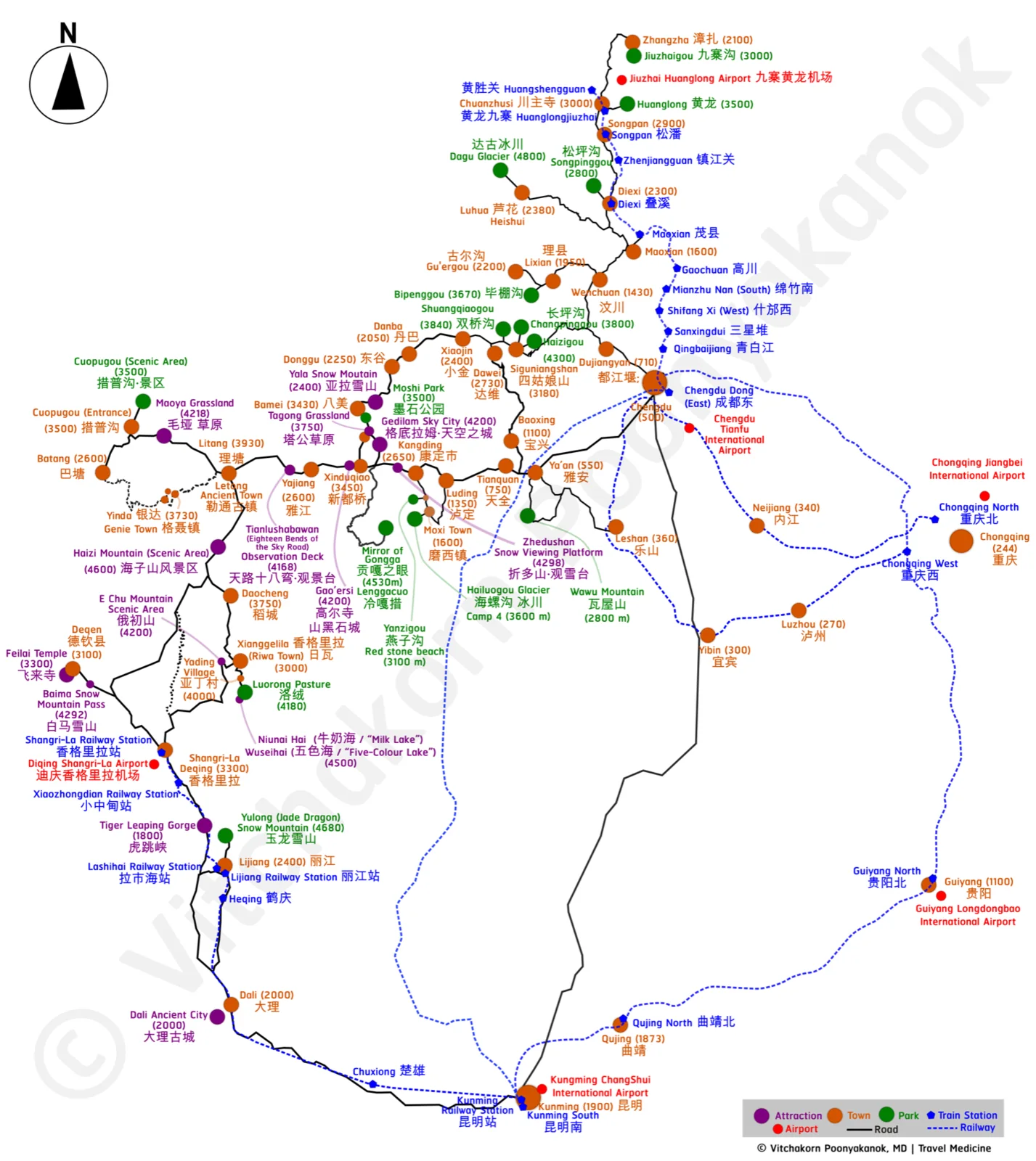
Since Thailand's visa-free travel policy expanded access to China, travel-medicine consults for high-altitude Sichuan itineraries — Yading, Litang, Kangding, Siguniangshan, Shangri-La, Jiuzhaigou — have risen noticeably. Advising a patient on altitude-illness risk needs a single, at-a-glance view of where they're going and how high, but existing maps split each attraction or region onto separate sheets, and mix Chinese place names, English place names, and altitude figures in ways that are slow to read in a time-pressured consult. There was no single map that let a physician walk a patient through a whole multi-stop itinerary's altitude profile in one view.
Built in QGIS as a large-format reference map spanning Chengdu, Lijiang, Yading, and Kunming, layering altitude figures in meters, categorized markers (towns, parks, attractions, airports, train stations) with a consistent color legend, and road and rail routes connecting every location — with bilingual Chinese/English labels throughout, so nothing requires a separate lookup.
The current published version is a high-resolution static export rather than an interactive web map — a deliberate choice for a reference asset meant to be glanced at quickly during a consult, not navigated.
A personal clinical reference tool, released publicly on GitHub under a share-with-attribution, no-derivatives license, consistent with sharing a finished reference asset rather than an editable template. The map explicitly disclaims authority over administrative boundaries and invites corrections.